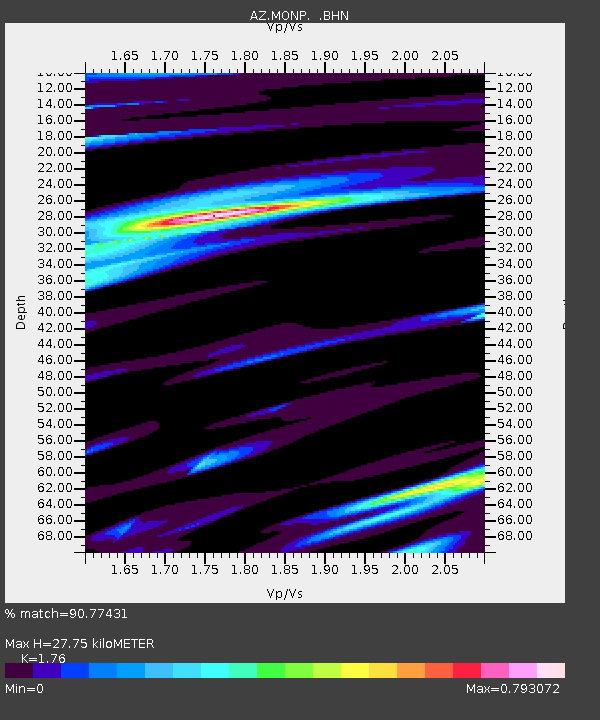
MONP AZ.MONP - Earthquake Result Viewer
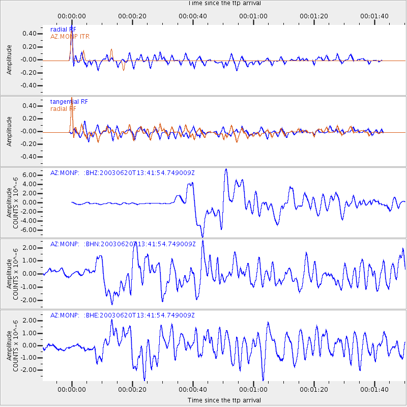
Earthquake location: Near Coast Of Central Chile
Earthquake latitude/longitude: -30.6/-71.6
Earthquake time(UTC): 2003/06/20 (171) 13:30:41 GMT
Earthquake Depth: 33 km
Earthquake Magnitude: 6.4 MB, 6.8 MS, 6.8 MW, 6.7 MW
Earthquake Catalog/Contributor: WHDF/NEIC
Network: AZ ANZA Regional Network
Station: MONP AZ.MONP
Lat/Lon: 32.89 N/116.42 W
Elevation: 1920 m
Distance: 76.1 deg
Az: 322.361 deg
Baz: 141.259 deg
Ray Param: 0.05120553
Estimated Moho Depth: 27.75 km
Estimated Crust Vp/Vs: 1.76
Assumed Crust Vp: 6.264 km/s
Estimated Crust Vs: 3.559 km/s
Estimated Crust Poisson's Ratio: 0.26
Radial Match: 90.77431 %
Radial Bump: 400
Transverse Match: 86.92134 %
Transverse Bump: 400
SOD ConfigId: 32974
Insert Time: 2010-02-26 19:59:08.177 +0000
GWidth: 2.5
Max Bumps: 400
Tol: 0.001

Signal To Noise

ChannelStoNSTALTA
AZ:MONP: :BHN:20030620T13:41:54.749009Z1.02061711.8501771E-71.8128023E-7
AZ:MONP: :BHE:20030620T13:41:54.749009Z1.14434722.2298131E-71.9485461E-7
AZ:MONP: :BHZ:20030620T13:41:54.749009Z4.33684645.506571E-71.2697178E-7
Arrivals
Ps3.5 SECOND
PpPs12 SECOND
PsPs/PpSs15 SECOND