You are here: Home > Network List > TA - USArray Transportable Network (new EarthScope stations) Stations List
> Station G26A Maurine, SD, USA > Earthquake Result Viewer
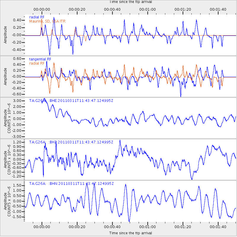
G26A Maurine, SD, USA - Earthquake Result Viewer
*The percent match for this event was below the threshold and hence no stack was calculated.
| Earthquake location: |
Off East Coast Of Honshu, Japan |
| Earthquake latitude/longitude: |
39.1/143.2 |
| Earthquake time(UTC): |
2011/03/11 (070) 11:32:27 GMT |
| Earthquake Depth: |
36 km |
| Earthquake Magnitude: |
5.8 MB |
| Earthquake Catalog/Contributor: |
WHDF/NEIC |
|
| Network: |
TA USArray Transportable Network (new EarthScope stations) |
| Station: |
G26A Maurine, SD, USA |
| Lat/Lon: |
45.29 N/102.60 W |
| Elevation: |
833 m |
|
| Distance: |
77.3 deg |
| Az: |
41.275 deg |
| Baz: |
313.318 deg |
| Ray Param: |
$rayparam |
*The percent match for this event was below the threshold and hence was not used in the summary stack. |
|
| Radial Match: |
63.415222 % |
| Radial Bump: |
334 |
| Transverse Match: |
63.201523 % |
| Transverse Bump: |
333 |
| SOD ConfigId: |
356183 |
| Insert Time: |
2011-08-15 09:24:00.063 +0000 |
| GWidth: |
2.5 |
| Max Bumps: |
400 |
| Tol: |
0.001 |
|
Signal To Noise
| Channel | StoN | STA | LTA |
| TA:G26A: :BHZ:20110311T11:43:47.124995Z | 1.1097165 | 5.132444E-7 | 4.6250045E-7 |
| TA:G26A: :BHN:20110311T11:43:47.124995Z | 0.55684745 | 4.1764946E-7 | 7.5002487E-7 |
| TA:G26A: :BHE:20110311T11:43:47.124995Z | 1.3802303 | 1.5957875E-6 | 1.1561748E-6 |
| Arrivals |
| Ps | |
| PpPs | |
| PsPs/PpSs | |


