You are here: Home > Network List > TA - USArray Transportable Network (new EarthScope stations) Stations List
> Station O33A Hebron, NE, USA > Earthquake Result Viewer
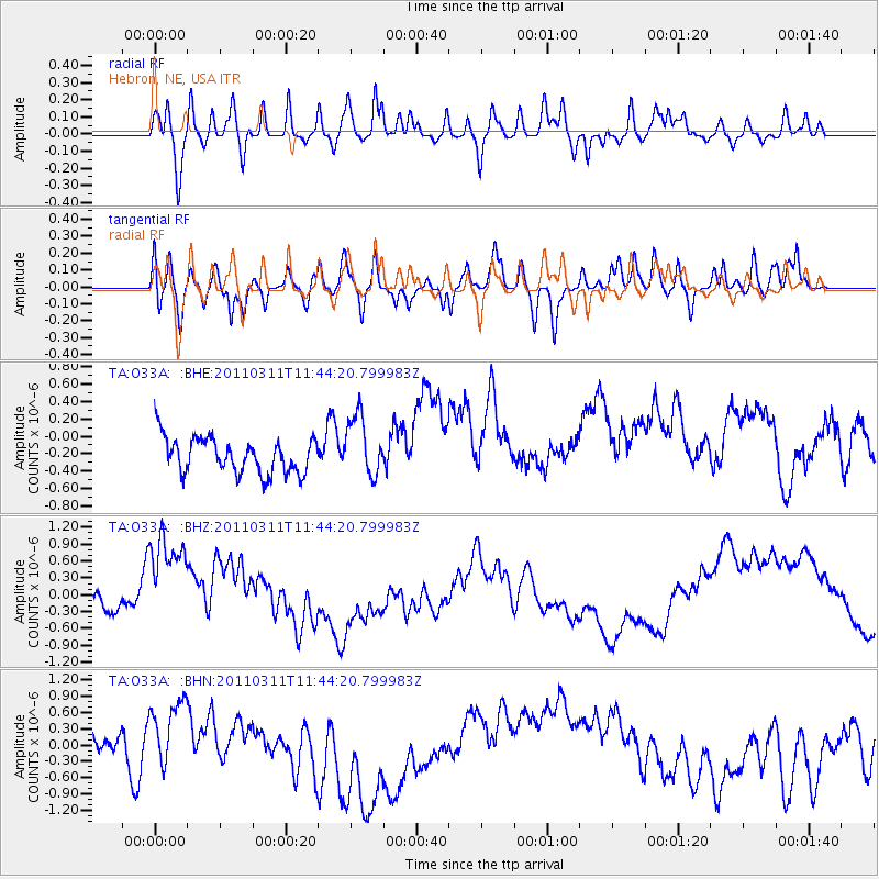
O33A Hebron, NE, USA - Earthquake Result Viewer
*The percent match for this event was below the threshold and hence no stack was calculated.
| Earthquake location: |
Off East Coast Of Honshu, Japan |
| Earthquake latitude/longitude: |
39.1/143.2 |
| Earthquake time(UTC): |
2011/03/11 (070) 11:32:27 GMT |
| Earthquake Depth: |
36 km |
| Earthquake Magnitude: |
5.8 MB |
| Earthquake Catalog/Contributor: |
WHDF/NEIC |
|
| Network: |
TA USArray Transportable Network (new EarthScope stations) |
| Station: |
O33A Hebron, NE, USA |
| Lat/Lon: |
40.08 N/97.58 W |
| Elevation: |
480 m |
|
| Distance: |
83.6 deg |
| Az: |
42.347 deg |
| Baz: |
316.888 deg |
| Ray Param: |
$rayparam |
*The percent match for this event was below the threshold and hence was not used in the summary stack. |
|
| Radial Match: |
41.386456 % |
| Radial Bump: |
400 |
| Transverse Match: |
50.92861 % |
| Transverse Bump: |
400 |
| SOD ConfigId: |
356183 |
| Insert Time: |
2011-08-15 09:48:07.576 +0000 |
| GWidth: |
2.5 |
| Max Bumps: |
400 |
| Tol: |
0.001 |
|
Signal To Noise
| Channel | StoN | STA | LTA |
| TA:O33A: :BHZ:20110311T11:44:20.799983Z | 4.362579 | 8.9154946E-7 | 2.0436293E-7 |
| TA:O33A: :BHN:20110311T11:44:20.799983Z | 2.2683387 | 6.0571705E-7 | 2.6703114E-7 |
| TA:O33A: :BHE:20110311T11:44:20.799983Z | 1.7377715 | 3.5405034E-7 | 2.0373814E-7 |
| Arrivals |
| Ps | |
| PpPs | |
| PsPs/PpSs | |


