You are here: Home > Network List > TA - USArray Transportable Network (new EarthScope stations) Stations List
> Station K34A Le Mars, IA, USA > Earthquake Result Viewer
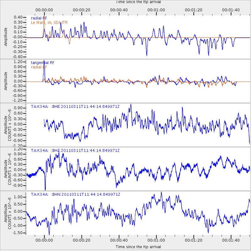
K34A Le Mars, IA, USA - Earthquake Result Viewer
*The percent match for this event was below the threshold and hence no stack was calculated.
| Earthquake location: |
Off East Coast Of Honshu, Japan |
| Earthquake latitude/longitude: |
39.1/143.2 |
| Earthquake time(UTC): |
2011/03/11 (070) 11:32:27 GMT |
| Earthquake Depth: |
36 km |
| Earthquake Magnitude: |
5.8 MB |
| Earthquake Catalog/Contributor: |
WHDF/NEIC |
|
| Network: |
TA USArray Transportable Network (new EarthScope stations) |
| Station: |
K34A Le Mars, IA, USA |
| Lat/Lon: |
42.69 N/96.10 W |
| Elevation: |
436 m |
|
| Distance: |
82.5 deg |
| Az: |
39.734 deg |
| Baz: |
317.553 deg |
| Ray Param: |
$rayparam |
*The percent match for this event was below the threshold and hence was not used in the summary stack. |
|
| Radial Match: |
43.327404 % |
| Radial Bump: |
315 |
| Transverse Match: |
47.09636 % |
| Transverse Bump: |
284 |
| SOD ConfigId: |
356183 |
| Insert Time: |
2011-08-15 09:53:00.183 +0000 |
| GWidth: |
2.5 |
| Max Bumps: |
400 |
| Tol: |
0.001 |
|
Signal To Noise
| Channel | StoN | STA | LTA |
| TA:K34A: :BHZ:20110311T11:44:14.849971Z | 2.07599 | 5.624555E-7 | 2.7093364E-7 |
| TA:K34A: :BHN:20110311T11:44:14.849971Z | 1.3708884 | 1.532204E-6 | 1.1176724E-6 |
| TA:K34A: :BHE:20110311T11:44:14.849971Z | 1.2848308 | 4.20433E-7 | 3.272283E-7 |
| Arrivals |
| Ps | |
| PpPs | |
| PsPs/PpSs | |


