
MONP AZ.MONP - Earthquake Result Viewer
| ||||||||||||||||||
| ||||||||||||||||||
| ||||||||||||||||||
|
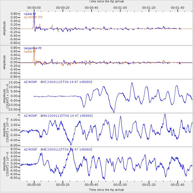
Signal To Noise
| Channel | StoN | STA | LTA |
| AZ:MONP: :BHN:20041115T09:14:47.148989Z | 2.7211185 | 1.0847427E-6 | 3.9863858E-7 |
| AZ:MONP: :BHE:20041115T09:14:47.148989Z | 4.9284487 | 2.4344179E-6 | 4.9395214E-7 |
| AZ:MONP: :BHZ:20041115T09:14:47.148989Z | 20.186558 | 4.913706E-6 | 2.4341475E-7 |
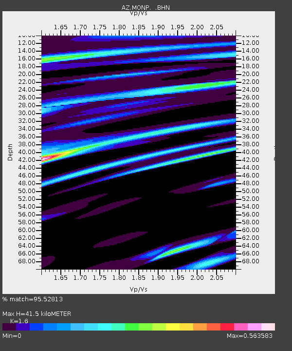
| Arrivals | |
| Ps | 4.2 SECOND |
| PpPs | 16 SECOND |
| PsPs/PpSs | 20 SECOND |

