
MONP AZ.MONP - Earthquake Result Viewer
| ||||||||||||||||||
| ||||||||||||||||||
| ||||||||||||||||||
|
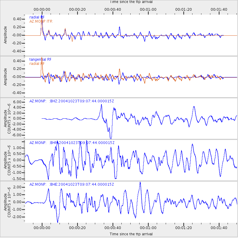
Signal To Noise
| Channel | StoN | STA | LTA |
| AZ:MONP: :BHN:20041023T09:07:44.000015Z | 3.0880284 | 6.260261E-7 | 2.0272681E-7 |
| AZ:MONP: :BHE:20041023T09:07:44.000015Z | 3.842004 | 7.5179133E-7 | 1.9567686E-7 |
| AZ:MONP: :BHZ:20041023T09:07:44.000015Z | 9.720537 | 1.935693E-6 | 1.9913438E-7 |
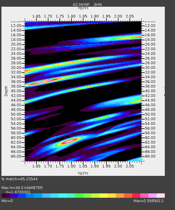
| Arrivals | |
| Ps | 4.0 SECOND |
| PpPs | 15 SECOND |
| PsPs/PpSs | 19 SECOND |

