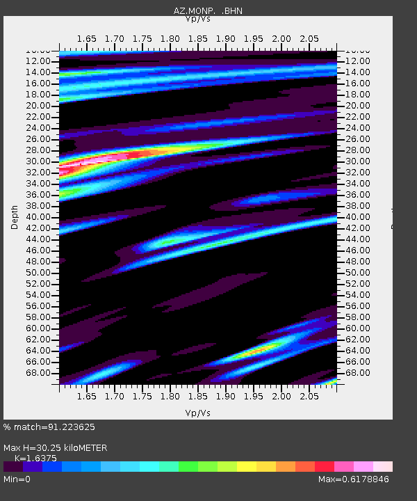
MONP AZ.MONP - Earthquake Result Viewer
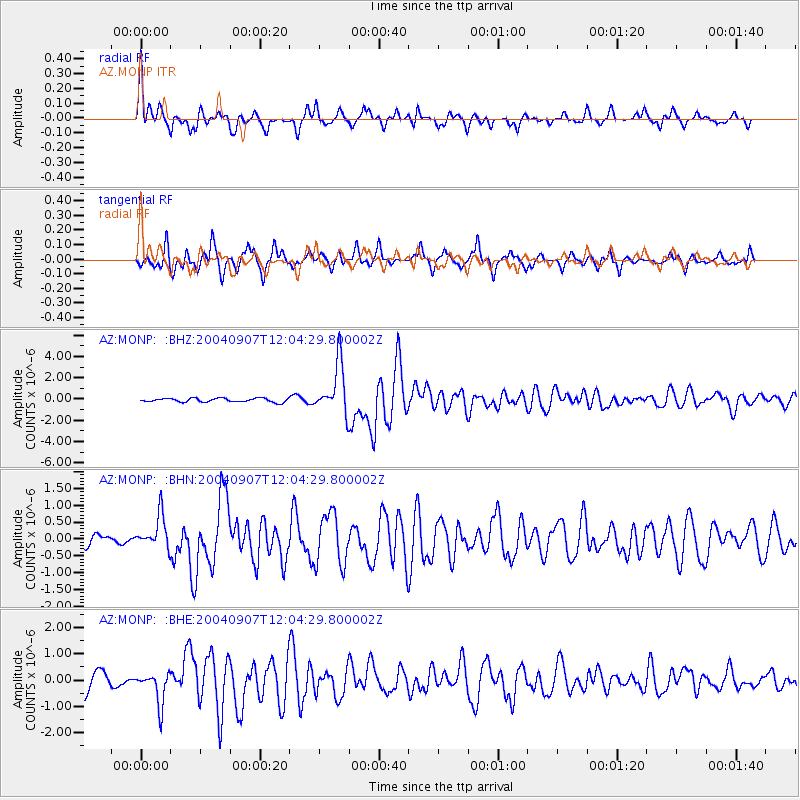
Earthquake location: Santiago Del Estero Prov., Arg.
Earthquake latitude/longitude: -28.6/-65.8
Earthquake time(UTC): 2004/09/07 (251) 11:53:06 GMT
Earthquake Depth: 22 km
Earthquake Magnitude: 6.1 MB, 6.1 MS, 6.4 MW, 6.2 MW
Earthquake Catalog/Contributor: WHDF/NEIC
Network: AZ ANZA Regional Network
Station: MONP AZ.MONP
Lat/Lon: 32.89 N/116.42 W
Elevation: 1920 m
Distance: 77.7 deg
Az: 318.303 deg
Baz: 135.941 deg
Ray Param: 0.05010783
Estimated Moho Depth: 30.25 km
Estimated Crust Vp/Vs: 1.64
Assumed Crust Vp: 6.264 km/s
Estimated Crust Vs: 3.825 km/s
Estimated Crust Poisson's Ratio: 0.20
Radial Match: 91.223625 %
Radial Bump: 320
Transverse Match: 84.86948 %
Transverse Bump: 351
SOD ConfigId: 2459
Insert Time: 2010-02-26 19:59:37.613 +0000
GWidth: 2.5
Max Bumps: 400
Tol: 0.001

Signal To Noise

ChannelStoNSTALTA
AZ:MONP: :BHN:20040907T12:04:29.800002Z2.69950274.892042E-71.812201E-7
AZ:MONP: :BHE:20040907T12:04:29.800002Z2.21669326.185554E-72.7904423E-7
AZ:MONP: :BHZ:20040907T12:04:29.800002Z12.9901652.362084E-61.8183633E-7
Arrivals
Ps3.2 SECOND
PpPs12 SECOND
PsPs/PpSs16 SECOND