You are here: Home > Network List > TA - USArray Transportable Network (new EarthScope stations) Stations List
> Station Z40A Long Farm, Magnolia, AR, USA > Earthquake Result Viewer
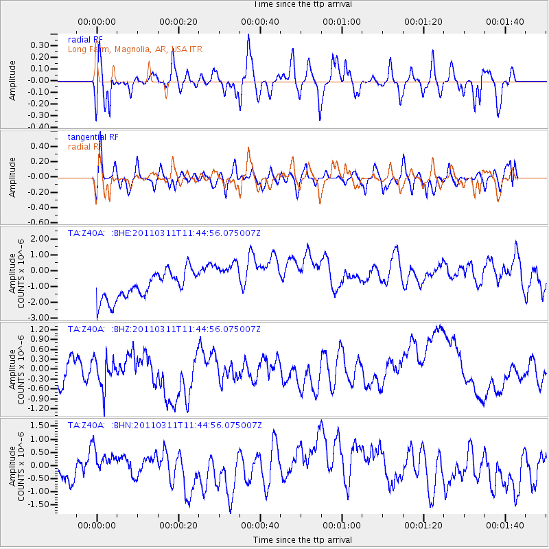
Z40A Long Farm, Magnolia, AR, USA - Earthquake Result Viewer
*The percent match for this event was below the threshold and hence no stack was calculated.
| Earthquake location: |
Off East Coast Of Honshu, Japan |
| Earthquake latitude/longitude: |
39.1/143.2 |
| Earthquake time(UTC): |
2011/03/11 (070) 11:32:27 GMT |
| Earthquake Depth: |
36 km |
| Earthquake Magnitude: |
5.8 MB |
| Earthquake Catalog/Contributor: |
WHDF/NEIC |
|
| Network: |
TA USArray Transportable Network (new EarthScope stations) |
| Station: |
Z40A Long Farm, Magnolia, AR, USA |
| Lat/Lon: |
33.26 N/93.40 W |
| Elevation: |
78 m |
|
| Distance: |
91.0 deg |
| Az: |
44.373 deg |
| Baz: |
319.476 deg |
| Ray Param: |
$rayparam |
*The percent match for this event was below the threshold and hence was not used in the summary stack. |
|
| Radial Match: |
48.453392 % |
| Radial Bump: |
400 |
| Transverse Match: |
54.11345 % |
| Transverse Bump: |
400 |
| SOD ConfigId: |
356183 |
| Insert Time: |
2011-08-15 10:13:20.221 +0000 |
| GWidth: |
2.5 |
| Max Bumps: |
400 |
| Tol: |
0.001 |
|
Signal To Noise
| Channel | StoN | STA | LTA |
| TA:Z40A: :BHZ:20110311T11:44:56.075007Z | 1.0602592 | 6.7697016E-7 | 6.3849495E-7 |
| TA:Z40A: :BHN:20110311T11:44:56.075007Z | 0.69094855 | 4.3551503E-7 | 6.3031473E-7 |
| TA:Z40A: :BHE:20110311T11:44:56.075007Z | 1.4572414 | 1.2488827E-6 | 8.5701834E-7 |
| Arrivals |
| Ps | |
| PpPs | |
| PsPs/PpSs | |


