
MONP AZ.MONP - Earthquake Result Viewer
| ||||||||||||||||||
| ||||||||||||||||||
| ||||||||||||||||||
|
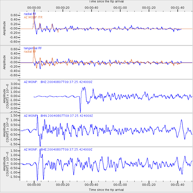
Signal To Noise
| Channel | StoN | STA | LTA |
| AZ:MONP: :BHN:20040807T09:37:25.424009Z | 11.132049 | 7.18466E-7 | 6.454032E-8 |
| AZ:MONP: :BHE:20040807T09:37:25.424009Z | 11.099774 | 8.3752786E-7 | 7.5454494E-8 |
| AZ:MONP: :BHZ:20040807T09:37:25.424009Z | 17.239828 | 1.4943502E-6 | 8.668011E-8 |
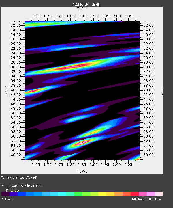
| Arrivals | |
| Ps | 9.0 SECOND |
| PpPs | 27 SECOND |
| PsPs/PpSs | 36 SECOND |

