MONP AZ.MONP - Earthquake Result Viewer
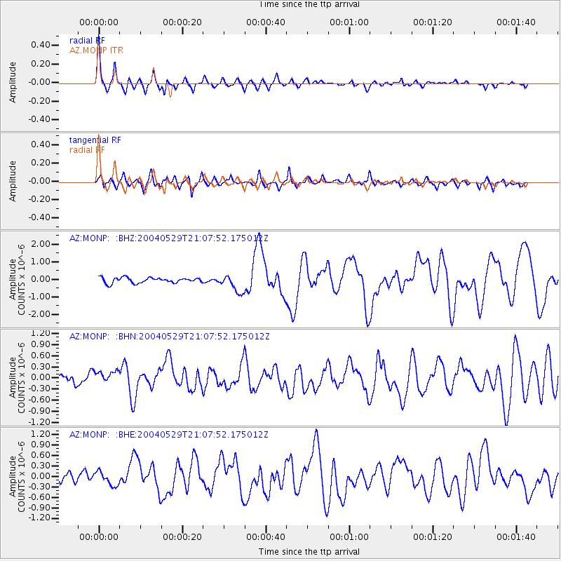
Earthquake location: Off East Coast Of Honshu, Japan
Earthquake latitude/longitude: 34.3/141.4
Earthquake time(UTC): 2004/05/29 (150) 20:56:09 GMT
Earthquake Depth: 16 km
Earthquake Magnitude: 5.6 MB, 6.6 MS, 6.5 MW, 6.3 MW
Earthquake Catalog/Contributor: WHDF/NEIC
Network: AZ ANZA Regional Network
Station: MONP AZ.MONP
Lat/Lon: 32.89 N/116.42 W
Elevation: 1920 m
Distance: 81.0 deg
Az: 56.368 deg
Baz: 304.942 deg
Ray Param: 0.047860406
Estimated Moho Depth: 30.5 km
Estimated Crust Vp/Vs: 1.79
Assumed Crust Vp: 6.264 km/s
Estimated Crust Vs: 3.504 km/s
Estimated Crust Poisson's Ratio: 0.27
Radial Match: 85.28781 %
Radial Bump: 400
Transverse Match: 77.21261 %
Transverse Bump: 400
SOD ConfigId: 2459
Insert Time: 2010-02-26 19:59:49.166 +0000
GWidth: 2.5
Max Bumps: 400
Tol: 0.001

Signal To Noise

ChannelStoNSTALTA
AZ:MONP: :BHN:20040529T21:07:52.175012Z1.847572.5460204E-71.3780372E-7
AZ:MONP: :BHE:20040529T21:07:52.175012Z1.84467521.926523E-71.0443697E-7
AZ:MONP: :BHZ:20040529T21:07:52.175012Z3.38936425.168454E-71.5249037E-7
Arrivals
Ps3.9 SECOND
PpPs13 SECOND
PsPs/PpSs17 SECOND