
MONP AZ.MONP - Earthquake Result Viewer
| ||||||||||||||||||
| ||||||||||||||||||
| ||||||||||||||||||
|
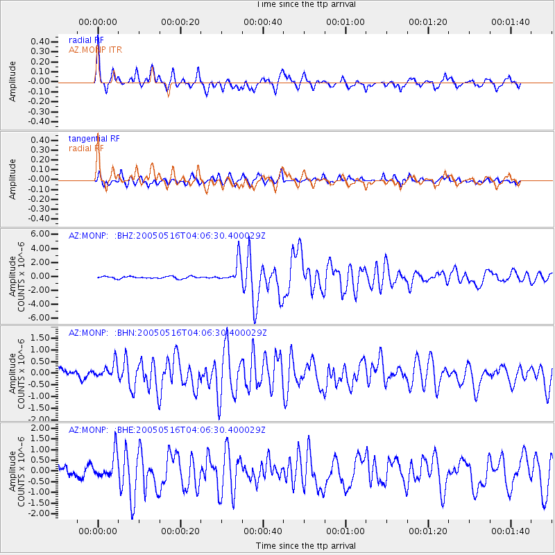
Signal To Noise
| Channel | StoN | STA | LTA |
| AZ:MONP: :BHN:20050516T04:06:30.400029Z | 1.9980624 | 3.8937674E-7 | 1.9487717E-7 |
| AZ:MONP: :BHE:20050516T04:06:30.400029Z | 4.0922914 | 6.1965665E-7 | 1.5142047E-7 |
| AZ:MONP: :BHZ:20050516T04:06:30.400029Z | 11.217774 | 1.6394908E-6 | 1.4615118E-7 |
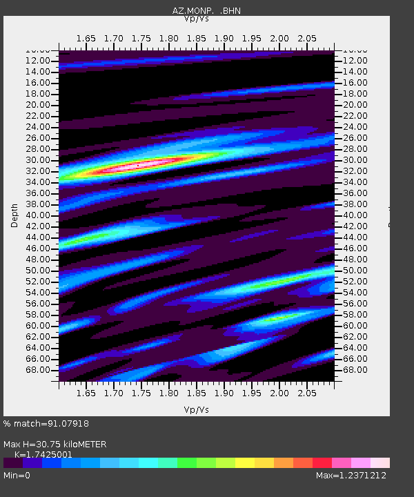
| Arrivals | |
| Ps | 3.7 SECOND |
| PpPs | 13 SECOND |
| PsPs/PpSs | 17 SECOND |

