MONP AZ.MONP - Earthquake Result Viewer
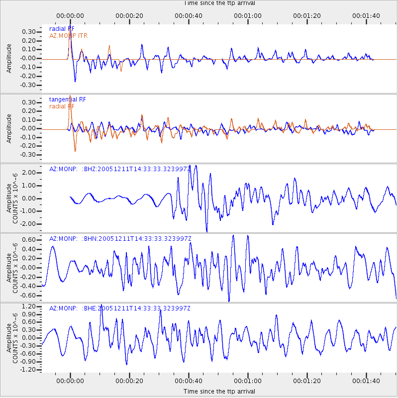
Earthquake location: New Britain Region, P.N.G.
Earthquake latitude/longitude: -6.6/152.2
Earthquake time(UTC): 2005/12/11 (345) 14:20:43 GMT
Earthquake Depth: 10 km
Earthquake Magnitude: 6.2 MB, 6.2 MS, 6.6 MW, 6.5 MW
Earthquake Catalog/Contributor: WHDF/NEIC
Network: AZ ANZA Regional Network
Station: MONP AZ.MONP
Lat/Lon: 32.89 N/116.42 W
Elevation: 1920 m
Distance: 94.7 deg
Az: 57.556 deg
Baz: 265.244 deg
Ray Param: 0.040983766
Estimated Moho Depth: 30.25 km
Estimated Crust Vp/Vs: 1.84
Assumed Crust Vp: 6.264 km/s
Estimated Crust Vs: 3.413 km/s
Estimated Crust Poisson's Ratio: 0.29
Radial Match: 80.955414 %
Radial Bump: 383
Transverse Match: 64.194824 %
Transverse Bump: 400
SOD ConfigId: 2422
Insert Time: 2010-02-26 20:00:04.209 +0000
GWidth: 2.5
Max Bumps: 400
Tol: 0.001

Signal To Noise

ChannelStoNSTALTA
AZ:MONP: :BHN:20051211T14:33:33.323997Z0.418009281.01599134E-72.4305473E-7
AZ:MONP: :BHE:20051211T14:33:33.323997Z1.36940242.7290113E-71.9928483E-7
AZ:MONP: :BHZ:20051211T14:33:33.323997Z2.23482684.840771E-72.1660607E-7
Arrivals
Ps4.1 SECOND
PpPs13 SECOND
PsPs/PpSs18 SECOND