MONP AZ.MONP - Earthquake Result Viewer
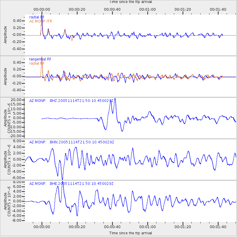
Earthquake location: Off East Coast Of Honshu, Japan
Earthquake latitude/longitude: 38.1/144.9
Earthquake time(UTC): 2005/11/14 (318) 21:38:51 GMT
Earthquake Depth: 11 km
Earthquake Magnitude: 6.7 MB, 6.8 MS, 7.0 MW, 6.9 MW
Earthquake Catalog/Contributor: WHDF/NEIC
Network: AZ ANZA Regional Network
Station: MONP AZ.MONP
Lat/Lon: 32.89 N/116.42 W
Elevation: 1920 m
Distance: 76.6 deg
Az: 58.763 deg
Baz: 306.707 deg
Ray Param: 0.05089307
Estimated Moho Depth: 31.5 km
Estimated Crust Vp/Vs: 1.75
Assumed Crust Vp: 6.264 km/s
Estimated Crust Vs: 3.574 km/s
Estimated Crust Poisson's Ratio: 0.26
Radial Match: 90.41414 %
Radial Bump: 400
Transverse Match: 84.69362 %
Transverse Bump: 400
SOD ConfigId: 2448
Insert Time: 2010-02-26 20:00:09.324 +0000
GWidth: 2.5
Max Bumps: 400
Tol: 0.001

Signal To Noise

ChannelStoNSTALTA
AZ:MONP: :BHN:20051114T21:50:10.450029Z0.90291845.253856E-75.81875E-7
AZ:MONP: :BHE:20051114T21:50:10.450029Z1.86133615.3381154E-72.8678946E-7
AZ:MONP: :BHZ:20051114T21:50:10.450029Z5.6591141.6983704E-63.0011242E-7
Arrivals
Ps3.9 SECOND
PpPs13 SECOND
PsPs/PpSs17 SECOND