MONP AZ.MONP - Earthquake Result Viewer
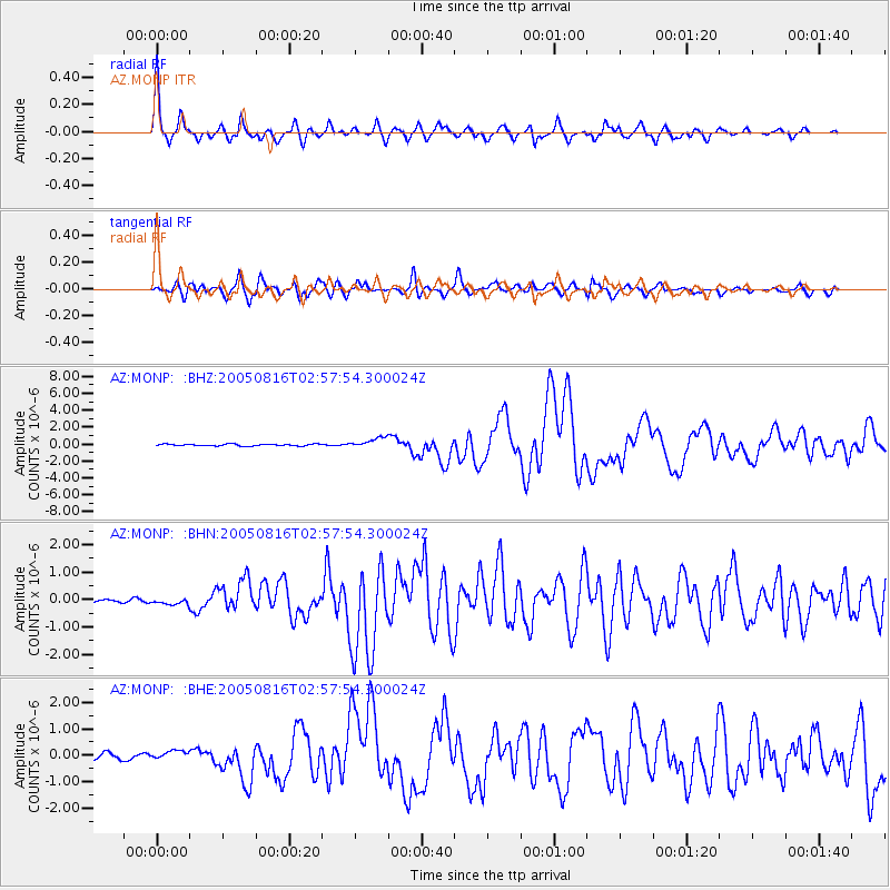
Earthquake location: Near East Coast Of Honshu, Japan
Earthquake latitude/longitude: 38.3/142.0
Earthquake time(UTC): 2005/08/16 (228) 02:46:28 GMT
Earthquake Depth: 36 km
Earthquake Magnitude: 6.5 MB, 6.8 MS, 7.2 MW, 7.1 MW
Earthquake Catalog/Contributor: WHDF/NEIC
Network: AZ ANZA Regional Network
Station: MONP AZ.MONP
Lat/Lon: 32.89 N/116.42 W
Elevation: 1920 m
Distance: 78.4 deg
Az: 57.3 deg
Baz: 308.075 deg
Ray Param: 0.049610306
Estimated Moho Depth: 30.25 km
Estimated Crust Vp/Vs: 1.70
Assumed Crust Vp: 6.264 km/s
Estimated Crust Vs: 3.69 km/s
Estimated Crust Poisson's Ratio: 0.23
Radial Match: 89.17484 %
Radial Bump: 400
Transverse Match: 82.14753 %
Transverse Bump: 400
SOD ConfigId: 2475
Insert Time: 2010-02-26 20:00:23.555 +0000
GWidth: 2.5
Max Bumps: 400
Tol: 0.001

Signal To Noise

ChannelStoNSTALTA
AZ:MONP: :BHN:20050816T02:57:54.300024Z0.948474658.0587895E-88.4965784E-8
AZ:MONP: :BHE:20050816T02:57:54.300024Z1.40096151.6892042E-71.2057463E-7
AZ:MONP: :BHZ:20050816T02:57:54.300024Z5.50069246.0674006E-71.10302494E-7
Arrivals
Ps3.5 SECOND
PpPs13 SECOND
PsPs/PpSs16 SECOND