You are here: Home > Network List > TA - USArray Transportable Network (new EarthScope stations) Stations List
> Station SFIN Lafayette, IN, USA > Earthquake Result Viewer
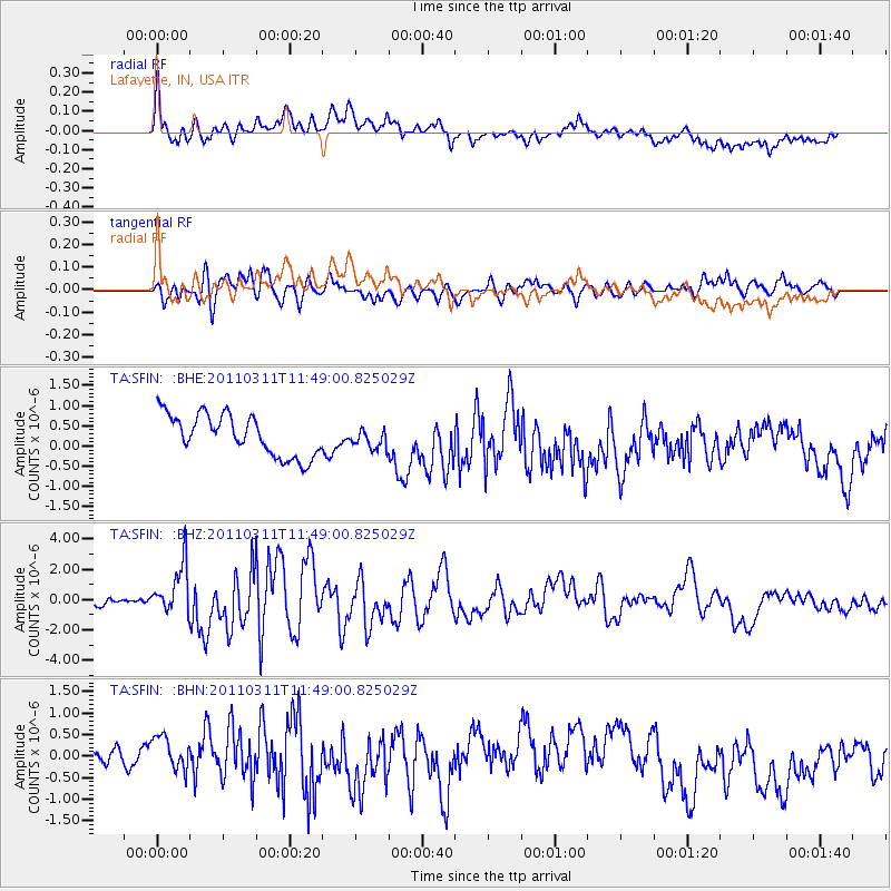
SFIN Lafayette, IN, USA - Earthquake Result Viewer
*The percent match for this event was below the threshold and hence no stack was calculated.
| Earthquake location: |
Near East Coast Of Honshu, Japan |
| Earthquake latitude/longitude: |
39.2/142.5 |
| Earthquake time(UTC): |
2011/03/11 (070) 11:36:40 GMT |
| Earthquake Depth: |
26 km |
| Earthquake Magnitude: |
6.5 MB, 6.6 MS |
| Earthquake Catalog/Contributor: |
WHDF/NEIC |
|
| Network: |
TA USArray Transportable Network (new EarthScope stations) |
| Station: |
SFIN Lafayette, IN, USA |
| Lat/Lon: |
40.38 N/87.10 W |
| Elevation: |
165 m |
|
| Distance: |
88.8 deg |
| Az: |
35.559 deg |
| Baz: |
323.76 deg |
| Ray Param: |
$rayparam |
*The percent match for this event was below the threshold and hence was not used in the summary stack. |
|
| Radial Match: |
64.25226 % |
| Radial Bump: |
400 |
| Transverse Match: |
69.118225 % |
| Transverse Bump: |
400 |
| SOD ConfigId: |
356183 |
| Insert Time: |
2011-08-15 12:22:03.897 +0000 |
| GWidth: |
2.5 |
| Max Bumps: |
400 |
| Tol: |
0.001 |
|
Signal To Noise
| Channel | StoN | STA | LTA |
| TA:SFIN: :BHZ:20110311T11:49:00.825029Z | 4.93951 | 1.7134104E-6 | 3.468786E-7 |
| TA:SFIN: :BHN:20110311T11:49:00.825029Z | 1.3948042 | 6.3048276E-7 | 4.5202242E-7 |
| TA:SFIN: :BHE:20110311T11:49:00.825029Z | 0.4784068 | 2.4346966E-7 | 5.0891765E-7 |
| Arrivals |
| Ps | |
| PpPs | |
| PsPs/PpSs | |


