You are here: Home > Network List > TA - USArray Transportable Network (new EarthScope stations) Stations List
> Station C28A Hausauer Farms, Kief, ND, USA > Earthquake Result Viewer
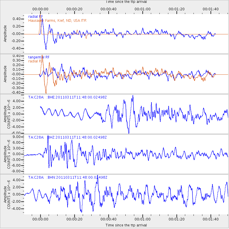
C28A Hausauer Farms, Kief, ND, USA - Earthquake Result Viewer

| Earthquake location: |
Near East Coast Of Honshu, Japan |
| Earthquake latitude/longitude: |
39.2/142.5 |
| Earthquake time(UTC): |
2011/03/11 (070) 11:36:40 GMT |
| Earthquake Depth: |
26 km |
| Earthquake Magnitude: |
6.5 MB, 6.6 MS |
| Earthquake Catalog/Contributor: |
WHDF/NEIC |
|
| Network: |
TA USArray Transportable Network (new EarthScope stations) |
| Station: |
C28A Hausauer Farms, Kief, ND, USA |
| Lat/Lon: |
47.72 N/100.39 W |
| Elevation: |
524 m |
|
| Distance: |
77.0 deg |
| Az: |
38.079 deg |
| Baz: |
314.826 deg |
| Ray Param: |
0.050603762 |
| Estimated Moho Depth: |
17.75 km |
| Estimated Crust Vp/Vs: |
1.60 |
| Assumed Crust Vp: |
6.438 km/s |
| Estimated Crust Vs: |
4.023 km/s |
| Estimated Crust Poisson's Ratio: |
0.18 |
|
| Radial Match: |
82.483444 % |
| Radial Bump: |
317 |
| Transverse Match: |
76.521454 % |
| Transverse Bump: |
400 |
| SOD ConfigId: |
356183 |
| Insert Time: |
2011-08-15 12:39:30.424 +0000 |
| GWidth: |
2.5 |
| Max Bumps: |
400 |
| Tol: |
0.001 |
|
Signal To Noise
| Channel | StoN | STA | LTA |
| TA:C28A: :BHZ:20110311T11:48:00.02498Z | 6.432785 | 2.9669322E-6 | 4.612205E-7 |
| TA:C28A: :BHN:20110311T11:48:00.02498Z | 0.8509029 | 8.454271E-7 | 9.935648E-7 |
| TA:C28A: :BHE:20110311T11:48:00.02498Z | 0.78967124 | 7.3299094E-7 | 9.282229E-7 |
| Arrivals |
| Ps | 1.7 SECOND |
| PpPs | 6.9 SECOND |
| PsPs/PpSs | 8.6 SECOND |


