You are here: Home > Network List > TA - USArray Transportable Network (new EarthScope stations) Stations List
> Station E28A Huff, ND, USA > Earthquake Result Viewer
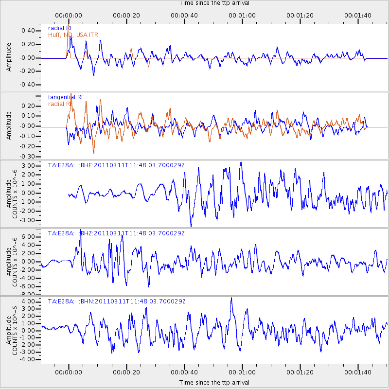
E28A Huff, ND, USA - Earthquake Result Viewer
*The percent match for this event was below the threshold and hence no stack was calculated.
| Earthquake location: |
Near East Coast Of Honshu, Japan |
| Earthquake latitude/longitude: |
39.2/142.5 |
| Earthquake time(UTC): |
2011/03/11 (070) 11:36:40 GMT |
| Earthquake Depth: |
26 km |
| Earthquake Magnitude: |
6.5 MB, 6.6 MS |
| Earthquake Catalog/Contributor: |
WHDF/NEIC |
|
| Network: |
TA USArray Transportable Network (new EarthScope stations) |
| Station: |
E28A Huff, ND, USA |
| Lat/Lon: |
46.57 N/100.69 W |
| Elevation: |
579 m |
|
| Distance: |
77.6 deg |
| Az: |
39.06 deg |
| Baz: |
314.818 deg |
| Ray Param: |
$rayparam |
*The percent match for this event was below the threshold and hence was not used in the summary stack. |
|
| Radial Match: |
67.41413 % |
| Radial Bump: |
360 |
| Transverse Match: |
67.45878 % |
| Transverse Bump: |
372 |
| SOD ConfigId: |
356183 |
| Insert Time: |
2011-08-15 12:40:11.200 +0000 |
| GWidth: |
2.5 |
| Max Bumps: |
400 |
| Tol: |
0.001 |
|
Signal To Noise
| Channel | StoN | STA | LTA |
| TA:E28A: :BHZ:20110311T11:48:03.700029Z | 4.295047 | 2.9515245E-6 | 6.8719265E-7 |
| TA:E28A: :BHN:20110311T11:48:03.700029Z | 1.1190919 | 7.052053E-7 | 6.301585E-7 |
| TA:E28A: :BHE:20110311T11:48:03.700029Z | 1.6129811 | 6.636123E-7 | 4.1141976E-7 |
| Arrivals |
| Ps | |
| PpPs | |
| PsPs/PpSs | |


