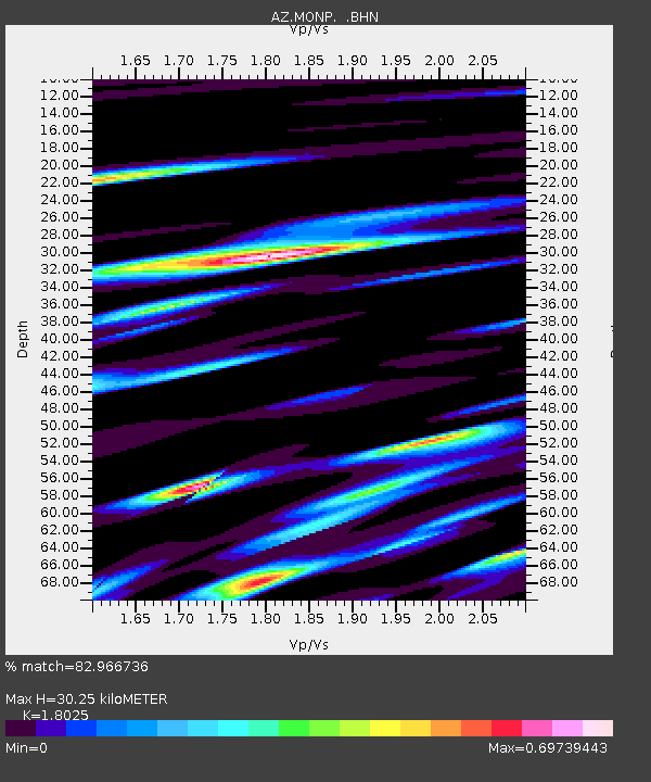
MONP AZ.MONP - Earthquake Result Viewer
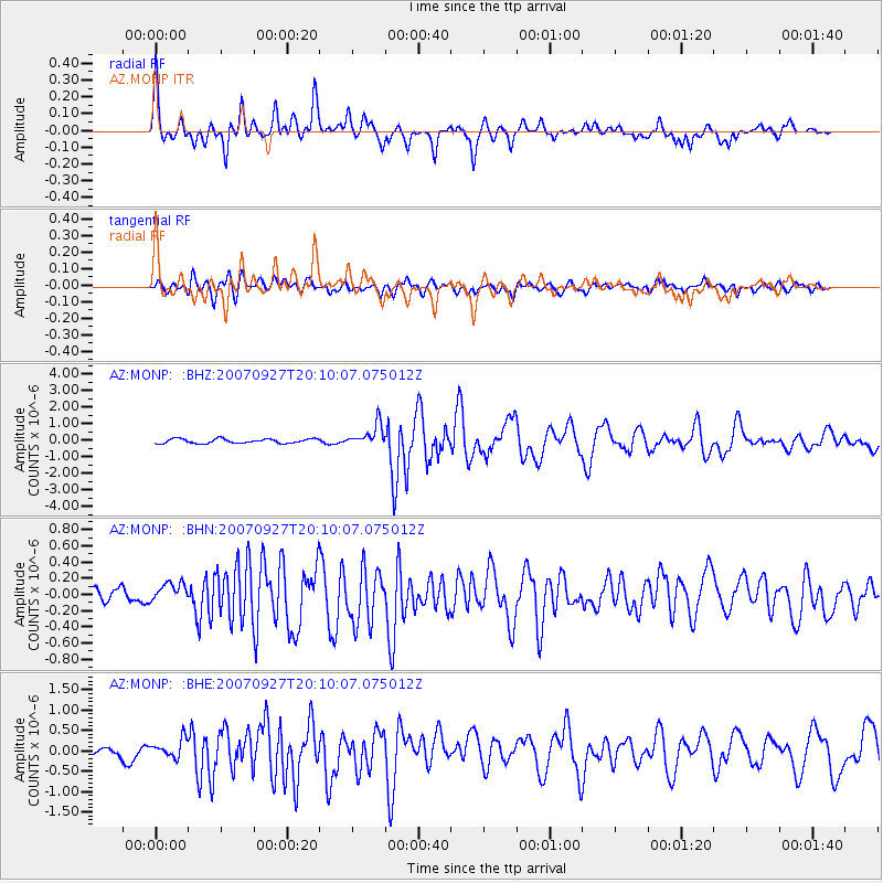
Earthquake location: Southeast Of Loyalty Islands
Earthquake latitude/longitude: -21.1/169.3
Earthquake time(UTC): 2007/09/27 (270) 19:57:44 GMT
Earthquake Depth: 9.0 km
Earthquake Magnitude: 6.2 MB, 6.3 MS, 6.1 MW, 6.1 MW
Earthquake Catalog/Contributor: WHDF/NEIC
Network: AZ ANZA Regional Network
Station: MONP AZ.MONP
Lat/Lon: 32.89 N/116.42 W
Elevation: 1920 m
Distance: 88.9 deg
Az: 54.104 deg
Baz: 244.033 deg
Ray Param: 0.0422436
Estimated Moho Depth: 30.25 km
Estimated Crust Vp/Vs: 1.80
Assumed Crust Vp: 6.264 km/s
Estimated Crust Vs: 3.475 km/s
Estimated Crust Poisson's Ratio: 0.28
Radial Match: 82.966736 %
Radial Bump: 400
Transverse Match: 82.38632 %
Transverse Bump: 400
SOD ConfigId: 2564
Insert Time: 2010-02-26 20:00:36.610 +0000
GWidth: 2.5
Max Bumps: 400
Tol: 0.001

Signal To Noise

ChannelStoNSTALTA
AZ:MONP: :BHN:20070927T20:10:07.075012Z0.942944171.0110732E-71.0722514E-7
AZ:MONP: :BHE:20070927T20:10:07.075012Z1.69376862.1753782E-71.284342E-7
AZ:MONP: :BHZ:20070927T20:10:07.075012Z5.05745176.7092253E-71.326602E-7
Arrivals
Ps4.0 SECOND
PpPs13 SECOND
PsPs/PpSs17 SECOND