You are here: Home > Network List > TA - USArray Transportable Network (new EarthScope stations) Stations List
> Station MDND Maddock, ND, USA > Earthquake Result Viewer
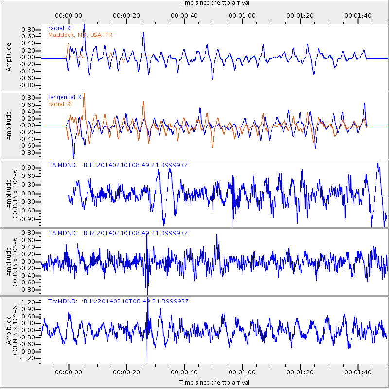
MDND Maddock, ND, USA - Earthquake Result Viewer
*The percent match for this event was below the threshold and hence no stack was calculated.
| Earthquake location: |
Bonin Islands, Japan Region |
| Earthquake latitude/longitude: |
28.3/140.0 |
| Earthquake time(UTC): |
2014/02/10 (041) 08:37:51 GMT |
| Earthquake Depth: |
413 km |
| Earthquake Magnitude: |
4.7 mb |
| Earthquake Catalog/Contributor: |
ISC/ISC |
|
| Network: |
TA USArray Transportable Network (new EarthScope stations) |
| Station: |
MDND Maddock, ND, USA |
| Lat/Lon: |
47.85 N/99.60 W |
| Elevation: |
479 m |
|
| Distance: |
87.3 deg |
| Az: |
35.552 deg |
| Baz: |
310.403 deg |
| Ray Param: |
$rayparam |
*The percent match for this event was below the threshold and hence was not used in the summary stack. |
|
| Radial Match: |
57.673958 % |
| Radial Bump: |
400 |
| Transverse Match: |
57.333958 % |
| Transverse Bump: |
400 |
| SOD ConfigId: |
3390531 |
| Insert Time: |
2019-04-10 07:03:28.753 +0000 |
| GWidth: |
2.5 |
| Max Bumps: |
400 |
| Tol: |
0.001 |
|
Signal To Noise
| Channel | StoN | STA | LTA |
| TA:MDND: :BHZ:20140210T08:49:21.399993Z | 1.9487988 | 2.205423E-7 | 1.1316833E-7 |
| TA:MDND: :BHN:20140210T08:49:21.399993Z | 1.5775192 | 3.844669E-7 | 2.4371616E-7 |
| TA:MDND: :BHE:20140210T08:49:21.399993Z | 2.8111842 | 5.990506E-7 | 2.1309548E-7 |
| Arrivals |
| Ps | |
| PpPs | |
| PsPs/PpSs | |


