You are here: Home > Network List > US - United States National Seismic Network Stations List
> Station DGMT Dagmar, Montana, USA > Earthquake Result Viewer
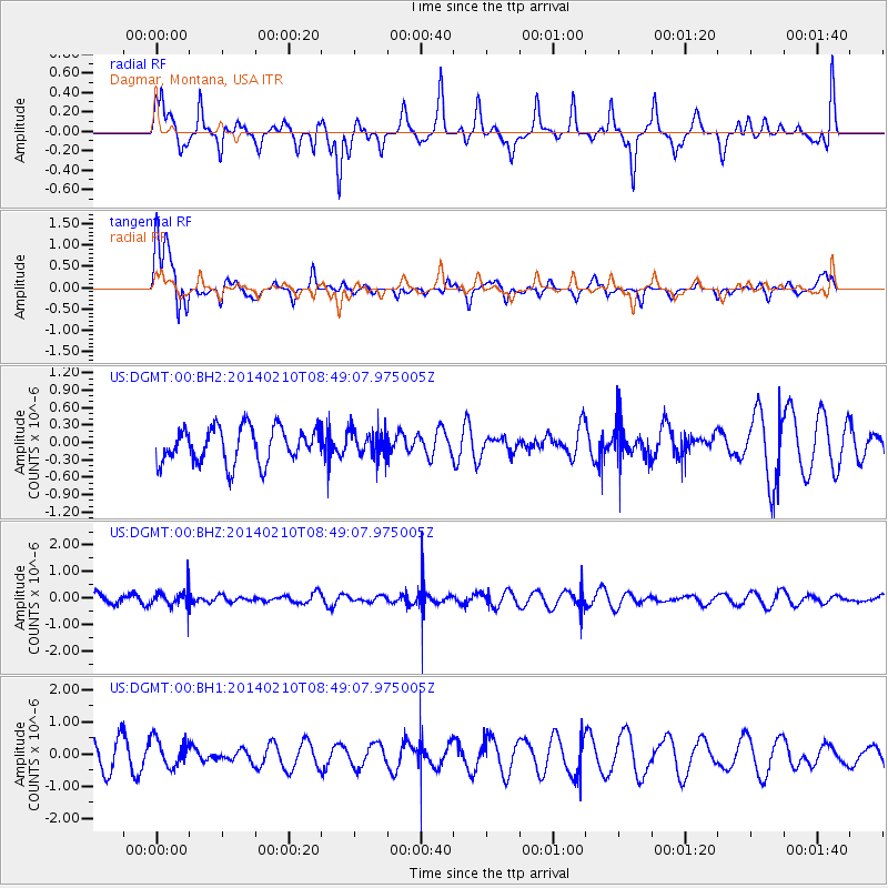
DGMT Dagmar, Montana, USA - Earthquake Result Viewer
*The percent match for this event was below the threshold and hence no stack was calculated.
| Earthquake location: |
Bonin Islands, Japan Region |
| Earthquake latitude/longitude: |
28.3/140.0 |
| Earthquake time(UTC): |
2014/02/10 (041) 08:37:51 GMT |
| Earthquake Depth: |
413 km |
| Earthquake Magnitude: |
4.7 mb |
| Earthquake Catalog/Contributor: |
ISC/ISC |
|
| Network: |
US United States National Seismic Network |
| Station: |
DGMT Dagmar, Montana, USA |
| Lat/Lon: |
48.47 N/104.20 W |
| Elevation: |
0.0 m |
|
| Distance: |
84.5 deg |
| Az: |
36.994 deg |
| Baz: |
307.094 deg |
| Ray Param: |
$rayparam |
*The percent match for this event was below the threshold and hence was not used in the summary stack. |
|
| Radial Match: |
66.58866 % |
| Radial Bump: |
400 |
| Transverse Match: |
65.1552 % |
| Transverse Bump: |
400 |
| SOD ConfigId: |
3390531 |
| Insert Time: |
2019-04-10 07:03:51.802 +0000 |
| GWidth: |
2.5 |
| Max Bumps: |
400 |
| Tol: |
0.001 |
|
Signal To Noise
| Channel | StoN | STA | LTA |
| US:DGMT:00:BHZ:20140210T08:49:07.975005Z | 1.376647 | 3.2231497E-7 | 2.3413043E-7 |
| US:DGMT:00:BH1:20140210T08:49:07.975005Z | 1.1597133 | 4.3741665E-7 | 3.7717652E-7 |
| US:DGMT:00:BH2:20140210T08:49:07.975005Z | 0.7578806 | 2.3009855E-7 | 3.036079E-7 |
| Arrivals |
| Ps | |
| PpPs | |
| PsPs/PpSs | |


