You are here: Home > Network List > TA - USArray Transportable Network (new EarthScope stations) Stations List
> Station 136A Ennis, TX, USA > Earthquake Result Viewer
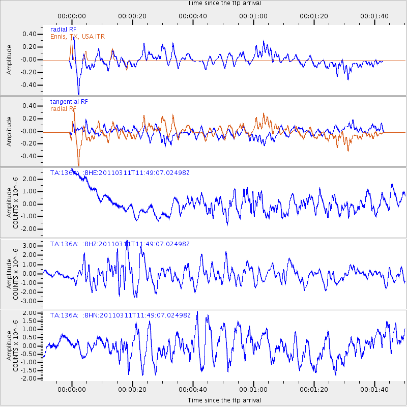
136A Ennis, TX, USA - Earthquake Result Viewer
*The percent match for this event was below the threshold and hence no stack was calculated.
| Earthquake location: |
Near East Coast Of Honshu, Japan |
| Earthquake latitude/longitude: |
39.2/142.5 |
| Earthquake time(UTC): |
2011/03/11 (070) 11:36:40 GMT |
| Earthquake Depth: |
26 km |
| Earthquake Magnitude: |
6.5 MB, 6.6 MS |
| Earthquake Catalog/Contributor: |
WHDF/NEIC |
|
| Network: |
TA USArray Transportable Network (new EarthScope stations) |
| Station: |
136A Ennis, TX, USA |
| Lat/Lon: |
32.47 N/96.53 W |
| Elevation: |
113 m |
|
| Distance: |
90.1 deg |
| Az: |
46.425 deg |
| Baz: |
318.272 deg |
| Ray Param: |
$rayparam |
*The percent match for this event was below the threshold and hence was not used in the summary stack. |
|
| Radial Match: |
69.11422 % |
| Radial Bump: |
351 |
| Transverse Match: |
56.654205 % |
| Transverse Bump: |
400 |
| SOD ConfigId: |
356183 |
| Insert Time: |
2011-08-15 13:15:26.631 +0000 |
| GWidth: |
2.5 |
| Max Bumps: |
400 |
| Tol: |
0.001 |
|
Signal To Noise
| Channel | StoN | STA | LTA |
| TA:136A: :BHZ:20110311T11:49:07.02498Z | 3.2226524 | 8.1726876E-7 | 2.5360126E-7 |
| TA:136A: :BHN:20110311T11:49:07.02498Z | 1.2097356 | 3.787886E-7 | 3.1311683E-7 |
| TA:136A: :BHE:20110311T11:49:07.02498Z | 1.105341 | 1.2222678E-6 | 1.1057834E-6 |
| Arrivals |
| Ps | |
| PpPs | |
| PsPs/PpSs | |


