You are here: Home > Network List > US - United States National Seismic Network Stations List
> Station WMOK Wichita Mountains, Oklahoma, USA > Earthquake Result Viewer
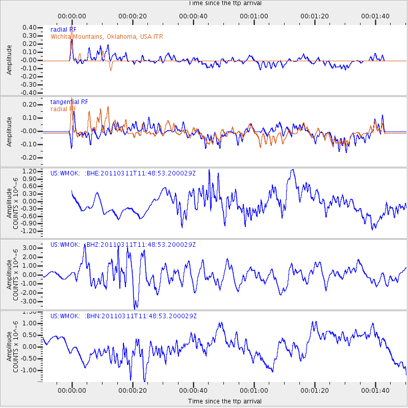
WMOK Wichita Mountains, Oklahoma, USA - Earthquake Result Viewer
*The percent match for this event was below the threshold and hence no stack was calculated.
| Earthquake location: |
Near East Coast Of Honshu, Japan |
| Earthquake latitude/longitude: |
39.2/142.5 |
| Earthquake time(UTC): |
2011/03/11 (070) 11:36:40 GMT |
| Earthquake Depth: |
26 km |
| Earthquake Magnitude: |
6.5 MB, 6.6 MS |
| Earthquake Catalog/Contributor: |
WHDF/NEIC |
|
| Network: |
US United States National Seismic Network |
| Station: |
WMOK Wichita Mountains, Oklahoma, USA |
| Lat/Lon: |
34.74 N/98.78 W |
| Elevation: |
486 m |
|
| Distance: |
87.2 deg |
| Az: |
46.293 deg |
| Baz: |
317.028 deg |
| Ray Param: |
$rayparam |
*The percent match for this event was below the threshold and hence was not used in the summary stack. |
|
| Radial Match: |
58.027744 % |
| Radial Bump: |
359 |
| Transverse Match: |
51.242702 % |
| Transverse Bump: |
400 |
| SOD ConfigId: |
356183 |
| Insert Time: |
2011-08-15 14:03:23.596 +0000 |
| GWidth: |
2.5 |
| Max Bumps: |
400 |
| Tol: |
0.001 |
|
Signal To Noise
| Channel | StoN | STA | LTA |
| US:WMOK: :BHZ:20110311T11:48:53.200029Z | 2.7261684 | 1.7522397E-6 | 6.4274815E-7 |
| US:WMOK: :BHN:20110311T11:48:53.200029Z | 3.2584312 | 9.509158E-7 | 2.918324E-7 |
| US:WMOK: :BHE:20110311T11:48:53.200029Z | 2.3760304 | 6.10967E-7 | 2.5713769E-7 |
| Arrivals |
| Ps | |
| PpPs | |
| PsPs/PpSs | |


