
MONP AZ.MONP - Earthquake Result Viewer
| ||||||||||||||||||
| ||||||||||||||||||
| ||||||||||||||||||
|
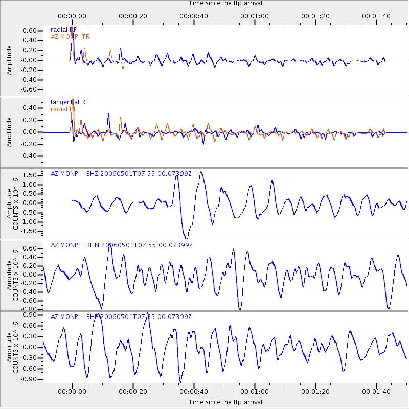
Signal To Noise
| Channel | StoN | STA | LTA |
| AZ:MONP: :BHN:20060501T07:55:00.07399Z | 0.6980373 | 1.9765012E-7 | 2.831512E-7 |
| AZ:MONP: :BHE:20060501T07:55:00.07399Z | 1.8524455 | 4.3170115E-7 | 2.3304392E-7 |
| AZ:MONP: :BHZ:20060501T07:55:00.07399Z | 2.8592207 | 6.72422E-7 | 2.3517669E-7 |
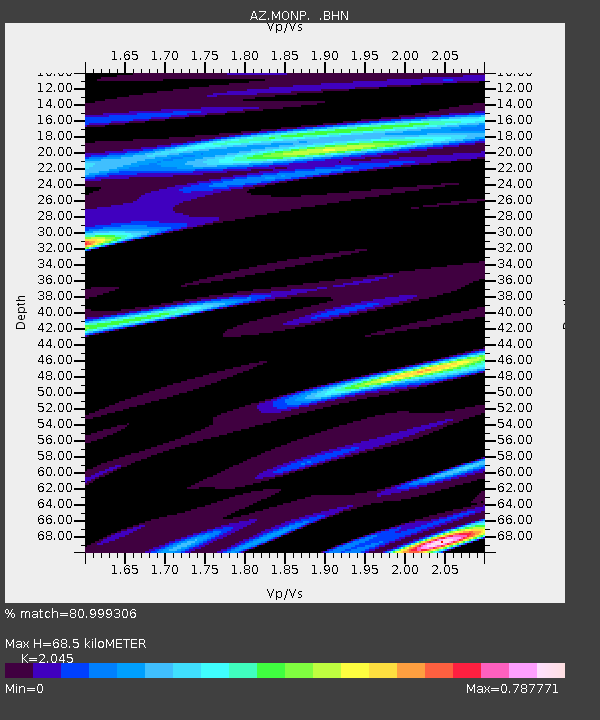
| Arrivals | |
| Ps | 12 SECOND |
| PpPs | 31 SECOND |
| PsPs/PpSs | 44 SECOND |

