
MONP AZ.MONP - Earthquake Result Viewer
| ||||||||||||||||||
| ||||||||||||||||||
| ||||||||||||||||||
|
Signal To Noise
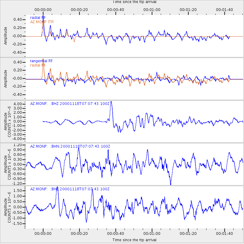
| Channel | StoN | STA | LTA |
| AZ:MONP: :BHN:20001118T07:07:43.100Z | 1.0191205 | 2.0182071E-7 | 1.9803421E-7 |
| AZ:MONP: :BHE:20001118T07:07:43.100Z | 0.666614 | 2.1195116E-7 | 3.1795187E-7 |
| AZ:MONP: :BHZ:20001118T07:07:43.100Z | 0.6152589 | 1.8049244E-7 | 2.9336016E-7 |
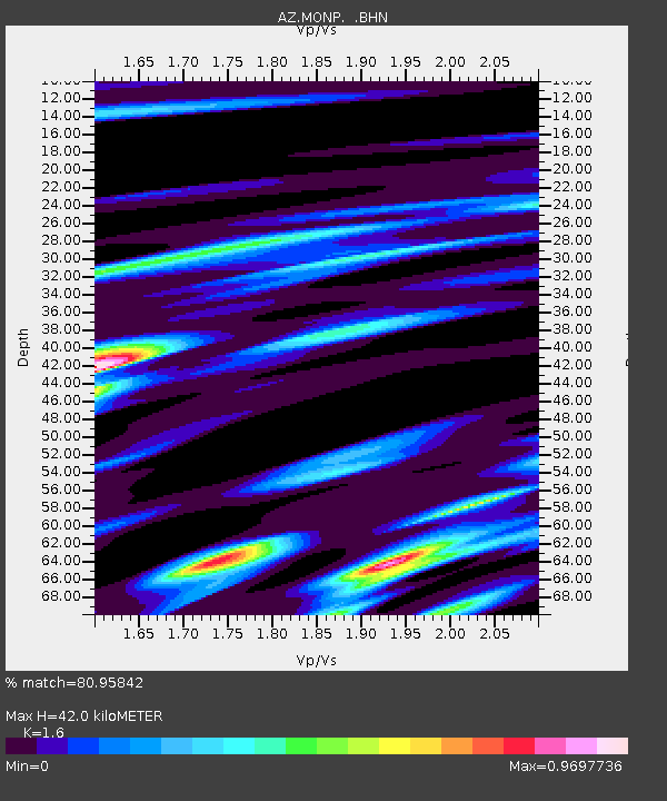
| Arrivals | |
| Ps | 4.1 SECOND |
| PpPs | 17 SECOND |
| PsPs/PpSs | 21 SECOND |

