
MONP AZ.MONP - Earthquake Result Viewer
| ||||||||||||||||||
| ||||||||||||||||||
| ||||||||||||||||||
|
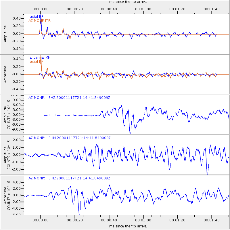
Signal To Noise
| Channel | StoN | STA | LTA |
| AZ:MONP: :BHN:20001117T21:14:41.849009Z | 0.74128634 | 1.1473365E-7 | 1.5477643E-7 |
| AZ:MONP: :BHE:20001117T21:14:41.849009Z | 0.83629066 | 5.2131946E-7 | 6.2337114E-7 |
| AZ:MONP: :BHZ:20001117T21:14:41.849009Z | 1.5044073 | 2.4965797E-7 | 1.6595105E-7 |
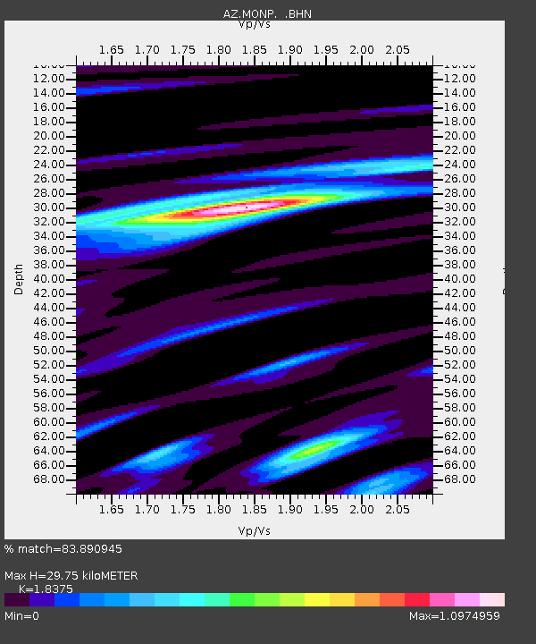
| Arrivals | |
| Ps | 4.1 SECOND |
| PpPs | 13 SECOND |
| PsPs/PpSs | 17 SECOND |

