You are here: Home > Network List > TA - USArray Transportable Network (new EarthScope stations) Stations List
> Station W56A Indian Trail, NC, USA > Earthquake Result Viewer
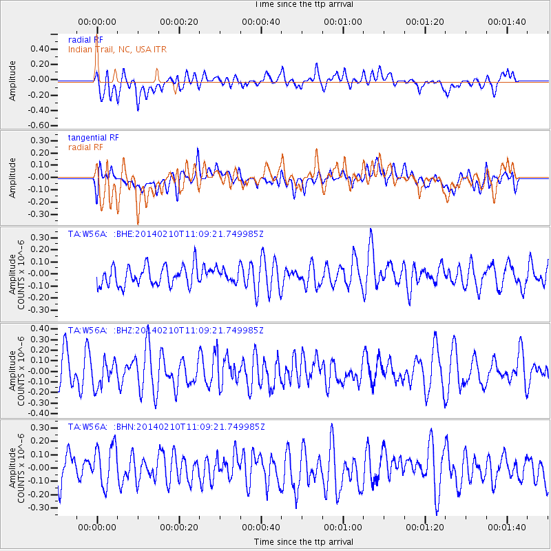
W56A Indian Trail, NC, USA - Earthquake Result Viewer
*The percent match for this event was below the threshold and hence no stack was calculated.
| Earthquake location: |
Northern Chile |
| Earthquake latitude/longitude: |
-22.3/-68.7 |
| Earthquake time(UTC): |
2014/02/10 (041) 11:00:09 GMT |
| Earthquake Depth: |
107 km |
| Earthquake Magnitude: |
5.2 MW |
| Earthquake Catalog/Contributor: |
ISC/ISC |
|
| Network: |
TA USArray Transportable Network (new EarthScope stations) |
| Station: |
W56A Indian Trail, NC, USA |
| Lat/Lon: |
35.13 N/80.58 W |
| Elevation: |
177 m |
|
| Distance: |
58.2 deg |
| Az: |
348.507 deg |
| Baz: |
166.985 deg |
| Ray Param: |
$rayparam |
*The percent match for this event was below the threshold and hence was not used in the summary stack. |
|
| Radial Match: |
47.541332 % |
| Radial Bump: |
400 |
| Transverse Match: |
50.03123 % |
| Transverse Bump: |
400 |
| SOD ConfigId: |
3390531 |
| Insert Time: |
2019-04-10 07:11:02.582 +0000 |
| GWidth: |
2.5 |
| Max Bumps: |
400 |
| Tol: |
0.001 |
|
Signal To Noise
| Channel | StoN | STA | LTA |
| TA:W56A: :BHZ:20140210T11:09:21.749985Z | 0.7698046 | 1.258845E-7 | 1.6352786E-7 |
| TA:W56A: :BHN:20140210T11:09:21.749985Z | 1.2561554 | 1.8512918E-7 | 1.4737762E-7 |
| TA:W56A: :BHE:20140210T11:09:21.749985Z | 0.67980665 | 5.543005E-8 | 8.153796E-8 |
| Arrivals |
| Ps | |
| PpPs | |
| PsPs/PpSs | |


