You are here: Home > Network List > TA - USArray Transportable Network (new EarthScope stations) Stations List
> Station 339A Huntington, TX, USA > Earthquake Result Viewer
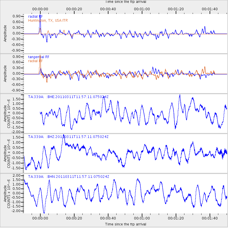
339A Huntington, TX, USA - Earthquake Result Viewer
*The percent match for this event was below the threshold and hence no stack was calculated.
| Earthquake location: |
Off East Coast Of Honshu, Japan |
| Earthquake latitude/longitude: |
36.7/142.2 |
| Earthquake time(UTC): |
2011/03/11 (070) 11:44:28 GMT |
| Earthquake Depth: |
35 km |
| Earthquake Magnitude: |
5.7 MB |
| Earthquake Catalog/Contributor: |
WHDF/NEIC |
|
| Network: |
TA USArray Transportable Network (new EarthScope stations) |
| Station: |
339A Huntington, TX, USA |
| Lat/Lon: |
31.33 N/94.56 W |
| Elevation: |
82 m |
|
| Distance: |
93.9 deg |
| Az: |
45.866 deg |
| Baz: |
317.613 deg |
| Ray Param: |
$rayparam |
*The percent match for this event was below the threshold and hence was not used in the summary stack. |
|
| Radial Match: |
60.54173 % |
| Radial Bump: |
400 |
| Transverse Match: |
68.07397 % |
| Transverse Bump: |
400 |
| SOD ConfigId: |
356183 |
| Insert Time: |
2011-08-15 15:57:50.062 +0000 |
| GWidth: |
2.5 |
| Max Bumps: |
400 |
| Tol: |
0.001 |
|
Signal To Noise
| Channel | StoN | STA | LTA |
| TA:339A: :BHZ:20110311T11:57:11.075024Z | 1.3333371 | 9.3982266E-7 | 7.04865E-7 |
| TA:339A: :BHN:20110311T11:57:11.075024Z | 1.5932027 | 1.206015E-6 | 7.569753E-7 |
| TA:339A: :BHE:20110311T11:57:11.075024Z | 0.7469585 | 4.479495E-7 | 5.99698E-7 |
| Arrivals |
| Ps | |
| PpPs | |
| PsPs/PpSs | |


