MONP AZ.MONP - Earthquake Result Viewer
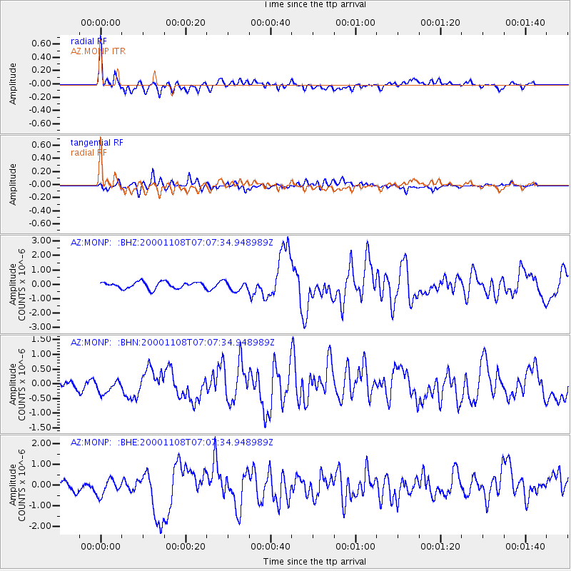
Earthquake location: Panama-Colombia Border Region
Earthquake latitude/longitude: 7.0/-77.8
Earthquake time(UTC): 2000/11/08 (313) 06:59:58 GMT
Earthquake Depth: 17 km
Earthquake Magnitude: 6.0 MB, 6.4 MS, 6.5 MW, 6.2 ML
Earthquake Catalog/Contributor: WHDF/NEIC
Network: AZ ANZA Regional Network
Station: MONP AZ.MONP
Lat/Lon: 32.89 N/116.42 W
Elevation: 1920 m
Distance: 44.1 deg
Az: 311.01 deg
Baz: 117.1 deg
Ray Param: 0.07212662
Estimated Moho Depth: 32.0 km
Estimated Crust Vp/Vs: 1.74
Assumed Crust Vp: 6.264 km/s
Estimated Crust Vs: 3.6 km/s
Estimated Crust Poisson's Ratio: 0.25
Radial Match: 82.62459 %
Radial Bump: 400
Transverse Match: 71.26577 %
Transverse Bump: 400
SOD ConfigId: 3744
Insert Time: 2010-02-26 20:01:46.939 +0000
GWidth: 2.5
Max Bumps: 400
Tol: 0.001

Signal To Noise

ChannelStoNSTALTA
AZ:MONP: :BHN:20001108T07:07:34.948989Z0.83730652.5508868E-73.0465387E-7
AZ:MONP: :BHE:20001108T07:07:34.948989Z0.99925944.3183317E-74.321532E-7
AZ:MONP: :BHZ:20001108T07:07:34.948989Z1.44014493.2841686E-72.2804433E-7
Arrivals
Ps4.0 SECOND
PpPs13 SECOND
PsPs/PpSs17 SECOND