You are here: Home > Network List > TA - USArray Transportable Network (new EarthScope stations) Stations List
> Station F36A Milaca, MN, USA > Earthquake Result Viewer
F36A Milaca, MN, USA - Earthquake Result Viewer
*The percent match for this event was below the threshold and hence no stack was calculated.
| Earthquake location: |
Off East Coast Of Honshu, Japan |
| Earthquake latitude/longitude: |
36.7/142.2 |
| Earthquake time(UTC): |
2011/03/11 (070) 11:44:28 GMT |
| Earthquake Depth: |
35 km |
| Earthquake Magnitude: |
5.7 MB |
| Earthquake Catalog/Contributor: |
WHDF/NEIC |
|
| Network: |
TA USArray Transportable Network (new EarthScope stations) |
| Station: |
F36A Milaca, MN, USA |
| Lat/Lon: |
45.86 N/93.52 W |
| Elevation: |
345 m |
|
| Distance: |
83.7 deg |
| Az: |
35.538 deg |
| Baz: |
318.045 deg |
| Ray Param: |
$rayparam |
*The percent match for this event was below the threshold and hence was not used in the summary stack. |
|
| Radial Match: |
57.81017 % |
| Radial Bump: |
400 |
| Transverse Match: |
61.02851 % |
| Transverse Bump: |
400 |
| SOD ConfigId: |
356183 |
| Insert Time: |
2011-08-15 16:23:44.775 +0000 |
| GWidth: |
2.5 |
| Max Bumps: |
400 |
| Tol: |
0.001 |
|
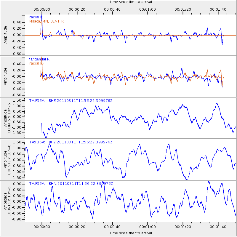
Signal To Noise
| Channel | StoN | STA | LTA |
| TA:F36A: :BHZ:20110311T11:56:22.399976Z | 1.5546353 | 1.1765039E-6 | 7.567716E-7 |
| TA:F36A: :BHN:20110311T11:56:22.399976Z | 0.96040124 | 5.4887363E-7 | 5.7150453E-7 |
| TA:F36A: :BHE:20110311T11:56:22.399976Z | 1.6541733 | 1.2639454E-6 | 7.640949E-7 |
| Arrivals |
| Ps | |
| PpPs | |
| PsPs/PpSs | |


