You are here: Home > Network List > AZ - ANZA Regional Network Stations List
> Station MONP AZ.MONP > Earthquake Result Viewer
MONP AZ.MONP - Earthquake Result Viewer

| Earthquake location: |
Bonin Islands, Japan Region |
| Earthquake latitude/longitude: |
28.9/139.6 |
| Earthquake time(UTC): |
2000/08/06 (219) 07:27:12 GMT |
| Earthquake Depth: |
395 km |
| Earthquake Magnitude: |
6.3 MB, 7.3 MW, 7.3 MW |
| Earthquake Catalog/Contributor: |
WHDF/NEIC |
|
| Network: |
AZ ANZA Regional Network |
| Station: |
MONP AZ.MONP |
| Lat/Lon: |
32.89 N/116.42 W |
| Elevation: |
1920 m |
|
| Distance: |
85.4 deg |
| Az: |
54.98 deg |
| Baz: |
301.367 deg |
| Ray Param: |
0.043777056 |
| Estimated Moho Depth: |
32.0 km |
| Estimated Crust Vp/Vs: |
1.60 |
| Assumed Crust Vp: |
6.264 km/s |
| Estimated Crust Vs: |
3.915 km/s |
| Estimated Crust Poisson's Ratio: |
0.18 |
|
| Radial Match: |
91.89314 % |
| Radial Bump: |
400 |
| Transverse Match: |
75.73627 % |
| Transverse Bump: |
400 |
| SOD ConfigId: |
3744 |
| Insert Time: |
2010-02-26 20:01:59.140 +0000 |
| GWidth: |
2.5 |
| Max Bumps: |
400 |
| Tol: |
0.001 |
|
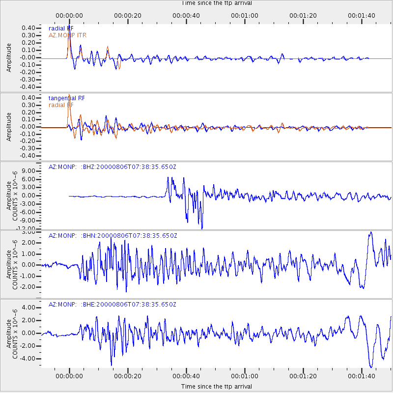
Signal To Noise
| Channel | StoN | STA | LTA |
| AZ:MONP: :BHN:20000806T07:38:35.650Z | 1.9042851 | 4.0130917E-7 | 2.1074005E-7 |
| AZ:MONP: :BHE:20000806T07:38:35.650Z | 3.8702564 | 4.7260968E-7 | 1.2211328E-7 |
| AZ:MONP: :BHZ:20000806T07:38:35.650Z | 15.980673 | 1.9385639E-6 | 1.2130677E-7 |
| Arrivals |
| Ps | 3.1 SECOND |
| PpPs | 13 SECOND |
| PsPs/PpSs | 16 SECOND |


