You are here: Home > Network List > AZ - ANZA Regional Network Stations List
> Station MONP AZ.MONP > Earthquake Result Viewer
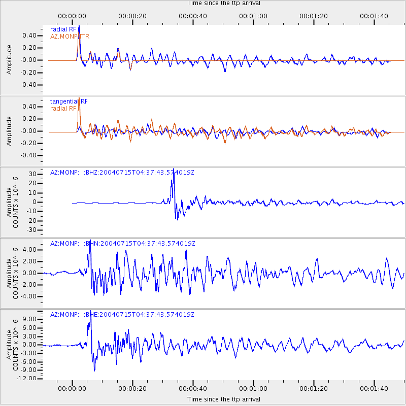
MONP AZ.MONP - Earthquake Result Viewer
*The percent match for this event was below the threshold and hence no stack was calculated.
| Earthquake location: |
Fiji Islands Region |
| Earthquake latitude/longitude: |
-17.6/-178.6 |
| Earthquake time(UTC): |
2004/07/15 (197) 04:27:12 GMT |
| Earthquake Depth: |
560 km |
| Earthquake Magnitude: |
5.5 MB |
| Earthquake Catalog/Contributor: |
WHDF/NEIC |
|
| Network: |
AZ ANZA Regional Network |
| Station: |
MONP AZ.MONP |
| Lat/Lon: |
32.89 N/116.42 W |
| Elevation: |
1920 m |
|
| Distance: |
77.8 deg |
| Az: |
49.59 deg |
| Baz: |
239.654 deg |
| Ray Param: |
$rayparam |
*The percent match for this event was below the threshold and hence was not used in the summary stack. |
|
| Radial Match: |
90.39707 % |
| Radial Bump: |
400 |
| Transverse Match: |
87.37128 % |
| Transverse Bump: |
400 |
| SOD ConfigId: |
2459 |
| Insert Time: |
2010-02-26 20:02:14.261 +0000 |
| GWidth: |
2.5 |
| Max Bumps: |
400 |
| Tol: |
0.001 |
|
Signal To Noise
| Channel | StoN | STA | LTA |
| AZ:MONP: :BHN:20040715T04:37:43.574019Z | 2.8154888 | 4.7826006E-7 | 1.698675E-7 |
| AZ:MONP: :BHE:20040715T04:37:43.574019Z | 4.15126 | 5.3638973E-7 | 1.292113E-7 |
| AZ:MONP: :BHZ:20040715T04:37:43.574019Z | 14.345068 | 2.0367897E-6 | 1.4198537E-7 |
| Arrivals |
| Ps | |
| PpPs | |
| PsPs/PpSs | |


