You are here: Home > Network List > AV - Alaska Volcano Observatory Stations List
> Station SPCR Ckakachatna River, Mount Spurr, Alaska > Earthquake Result Viewer
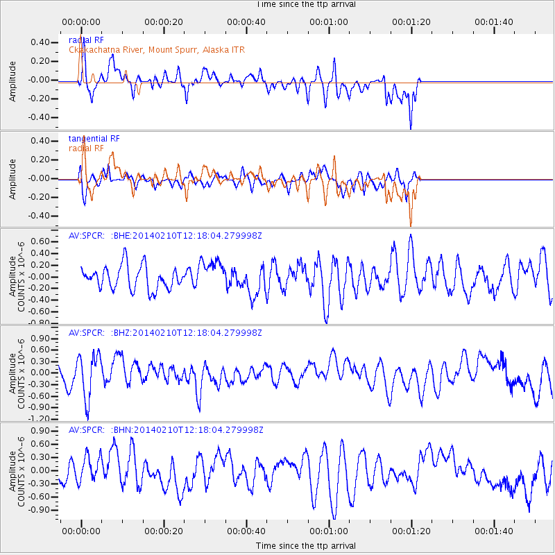
SPCR Ckakachatna River, Mount Spurr, Alaska - Earthquake Result Viewer
*The percent match for this event was below the threshold and hence no stack was calculated.
| Earthquake location: |
Eastern Caucasus |
| Earthquake latitude/longitude: |
40.3/48.8 |
| Earthquake time(UTC): |
2014/02/10 (041) 12:06:46 GMT |
| Earthquake Depth: |
63 km |
| Earthquake Magnitude: |
5.5 MW |
| Earthquake Catalog/Contributor: |
ISC/ISC |
|
| Network: |
AV Alaska Volcano Observatory |
| Station: |
SPCR Ckakachatna River, Mount Spurr, Alaska |
| Lat/Lon: |
61.20 N/152.21 W |
| Elevation: |
984 m |
|
| Distance: |
77.4 deg |
| Az: |
10.227 deg |
| Baz: |
343.707 deg |
| Ray Param: |
$rayparam |
*The percent match for this event was below the threshold and hence was not used in the summary stack. |
|
| Radial Match: |
69.13653 % |
| Radial Bump: |
352 |
| Transverse Match: |
56.759598 % |
| Transverse Bump: |
390 |
| SOD ConfigId: |
3390531 |
| Insert Time: |
2019-04-10 07:14:26.354 +0000 |
| GWidth: |
2.5 |
| Max Bumps: |
400 |
| Tol: |
0.001 |
|
Signal To Noise
| Channel | StoN | STA | LTA |
| AV:SPCR: :BHZ:20140210T12:18:04.279998Z | 2.510867 | 5.7720666E-7 | 2.298834E-7 |
| AV:SPCR: :BHN:20140210T12:18:04.279998Z | 1.2822555 | 2.9913298E-7 | 2.3328656E-7 |
| AV:SPCR: :BHE:20140210T12:18:04.279998Z | 1.2990143 | 2.5608952E-7 | 1.9714142E-7 |
| Arrivals |
| Ps | |
| PpPs | |
| PsPs/PpSs | |


