You are here: Home > Network List > TA - USArray Transportable Network (new EarthScope stations) Stations List
> Station Y38A Idabel, OK, USA > Earthquake Result Viewer
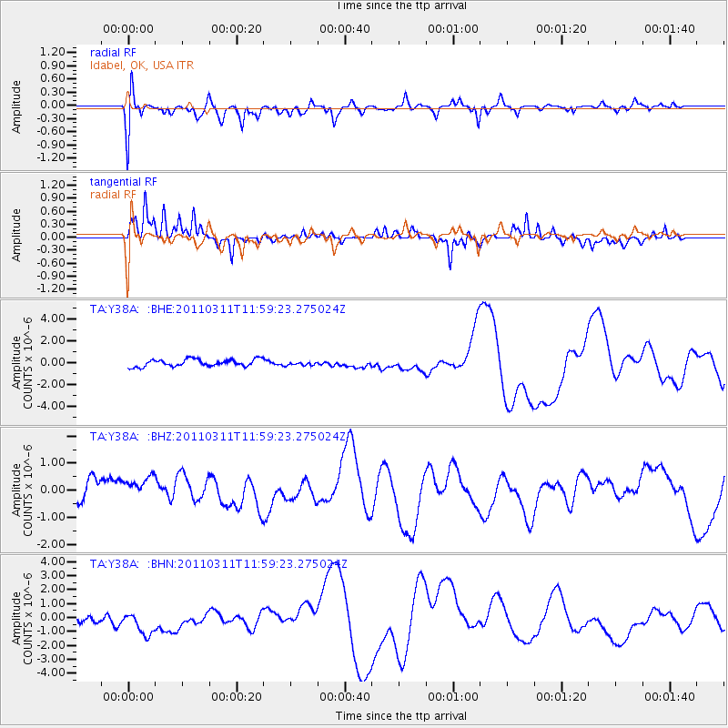
Y38A Idabel, OK, USA - Earthquake Result Viewer
*The percent match for this event was below the threshold and hence no stack was calculated.
| Earthquake location: |
Near East Coast Of Honshu, Japan |
| Earthquake latitude/longitude: |
36.0/141.2 |
| Earthquake time(UTC): |
2011/03/11 (070) 11:46:42 GMT |
| Earthquake Depth: |
18 km |
| Earthquake Magnitude: |
5.8 MB |
| Earthquake Catalog/Contributor: |
WHDF/NEIC |
|
| Network: |
TA USArray Transportable Network (new EarthScope stations) |
| Station: |
Y38A Idabel, OK, USA |
| Lat/Lon: |
33.93 N/94.73 W |
| Elevation: |
118 m |
|
| Distance: |
93.0 deg |
| Az: |
43.59 deg |
| Baz: |
317.749 deg |
| Ray Param: |
$rayparam |
*The percent match for this event was below the threshold and hence was not used in the summary stack. |
|
| Radial Match: |
40.61323 % |
| Radial Bump: |
400 |
| Transverse Match: |
49.38029 % |
| Transverse Bump: |
235 |
| SOD ConfigId: |
356183 |
| Insert Time: |
2011-08-15 18:45:20.800 +0000 |
| GWidth: |
2.5 |
| Max Bumps: |
400 |
| Tol: |
0.001 |
|
Signal To Noise
| Channel | StoN | STA | LTA |
| TA:Y38A: :BHZ:20110311T11:59:23.275024Z | 1.2631297 | 5.536769E-7 | 4.3833737E-7 |
| TA:Y38A: :BHN:20110311T11:59:23.275024Z | 1.8399962 | 1.275993E-6 | 6.934759E-7 |
| TA:Y38A: :BHE:20110311T11:59:23.275024Z | 0.5069753 | 1.6509696E-7 | 3.2565092E-7 |
| Arrivals |
| Ps | |
| PpPs | |
| PsPs/PpSs | |


