You are here: Home > Network List > TA - USArray Transportable Network (new EarthScope stations) Stations List
> Station J34A George, IA, USA > Earthquake Result Viewer
J34A George, IA, USA - Earthquake Result Viewer
*The percent match for this event was below the threshold and hence no stack was calculated.
| Earthquake location: |
Near East Coast Of Honshu, Japan |
| Earthquake latitude/longitude: |
36.0/141.2 |
| Earthquake time(UTC): |
2011/03/11 (070) 11:46:42 GMT |
| Earthquake Depth: |
18 km |
| Earthquake Magnitude: |
5.8 MB |
| Earthquake Catalog/Contributor: |
WHDF/NEIC |
|
| Network: |
TA USArray Transportable Network (new EarthScope stations) |
| Station: |
J34A George, IA, USA |
| Lat/Lon: |
43.28 N/95.96 W |
| Elevation: |
432 m |
|
| Distance: |
85.5 deg |
| Az: |
37.969 deg |
| Baz: |
316.911 deg |
| Ray Param: |
$rayparam |
*The percent match for this event was below the threshold and hence was not used in the summary stack. |
|
| Radial Match: |
48.61162 % |
| Radial Bump: |
325 |
| Transverse Match: |
45.10081 % |
| Transverse Bump: |
247 |
| SOD ConfigId: |
356183 |
| Insert Time: |
2011-08-15 18:58:18.511 +0000 |
| GWidth: |
2.5 |
| Max Bumps: |
400 |
| Tol: |
0.001 |
|
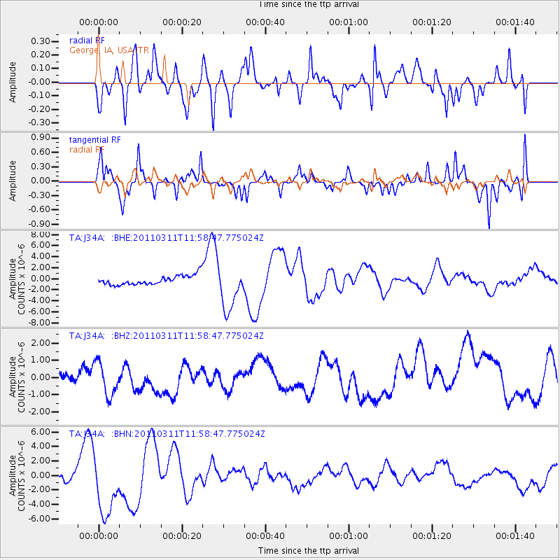
Signal To Noise
| Channel | StoN | STA | LTA |
| TA:J34A: :BHZ:20110311T11:58:47.775024Z | 2.1791346 | 1.0058418E-6 | 4.6157854E-7 |
| TA:J34A: :BHN:20110311T11:58:47.775024Z | 8.2760105 | 4.34631E-6 | 5.251697E-7 |
| TA:J34A: :BHE:20110311T11:58:47.775024Z | 4.7607036 | 4.082502E-6 | 8.575418E-7 |
| Arrivals |
| Ps | |
| PpPs | |
| PsPs/PpSs | |


