You are here: Home > Network List > TA - USArray Transportable Network (new EarthScope stations) Stations List
> Station B35A Bob, Littlefork, MN, USA > Earthquake Result Viewer
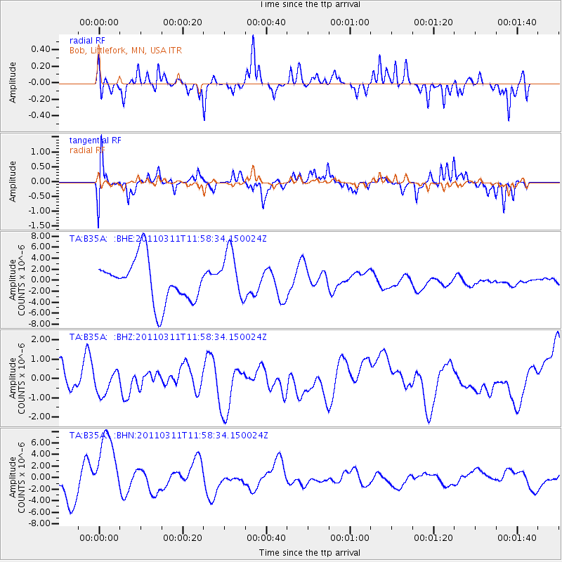
B35A Bob, Littlefork, MN, USA - Earthquake Result Viewer
*The percent match for this event was below the threshold and hence no stack was calculated.
| Earthquake location: |
Near East Coast Of Honshu, Japan |
| Earthquake latitude/longitude: |
36.0/141.2 |
| Earthquake time(UTC): |
2011/03/11 (070) 11:46:42 GMT |
| Earthquake Depth: |
18 km |
| Earthquake Magnitude: |
5.8 MB |
| Earthquake Catalog/Contributor: |
WHDF/NEIC |
|
| Network: |
TA USArray Transportable Network (new EarthScope stations) |
| Station: |
B35A Bob, Littlefork, MN, USA |
| Lat/Lon: |
48.36 N/93.73 W |
| Elevation: |
358 m |
|
| Distance: |
82.8 deg |
| Az: |
33.364 deg |
| Baz: |
318.039 deg |
| Ray Param: |
$rayparam |
*The percent match for this event was below the threshold and hence was not used in the summary stack. |
|
| Radial Match: |
46.535744 % |
| Radial Bump: |
323 |
| Transverse Match: |
38.73601 % |
| Transverse Bump: |
364 |
| SOD ConfigId: |
356183 |
| Insert Time: |
2011-08-15 19:12:38.730 +0000 |
| GWidth: |
2.5 |
| Max Bumps: |
400 |
| Tol: |
0.001 |
|
Signal To Noise
| Channel | StoN | STA | LTA |
| TA:B35A: :BHZ:20110311T11:58:34.150024Z | 1.3628138 | 8.085414E-7 | 5.9328823E-7 |
| TA:B35A: :BHN:20110311T11:58:34.150024Z | 2.1893585 | 6.3887132E-6 | 2.9180756E-6 |
| TA:B35A: :BHE:20110311T11:58:34.150024Z | 1.1587241 | 4.5108245E-6 | 3.892924E-6 |
| Arrivals |
| Ps | |
| PpPs | |
| PsPs/PpSs | |


