You are here: Home > Network List > US - United States National Seismic Network Stations List
> Station CBKS Cedar Bluff, Kansas, USA > Earthquake Result Viewer
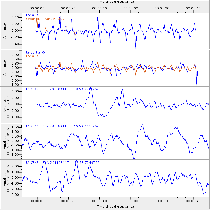
CBKS Cedar Bluff, Kansas, USA - Earthquake Result Viewer
*The percent match for this event was below the threshold and hence no stack was calculated.
| Earthquake location: |
Near East Coast Of Honshu, Japan |
| Earthquake latitude/longitude: |
36.0/141.2 |
| Earthquake time(UTC): |
2011/03/11 (070) 11:46:42 GMT |
| Earthquake Depth: |
18 km |
| Earthquake Magnitude: |
5.8 MB |
| Earthquake Catalog/Contributor: |
WHDF/NEIC |
|
| Network: |
US United States National Seismic Network |
| Station: |
CBKS Cedar Bluff, Kansas, USA |
| Lat/Lon: |
38.81 N/99.74 W |
| Elevation: |
677 m |
|
| Distance: |
86.7 deg |
| Az: |
43.142 deg |
| Baz: |
314.788 deg |
| Ray Param: |
$rayparam |
*The percent match for this event was below the threshold and hence was not used in the summary stack. |
|
| Radial Match: |
59.76213 % |
| Radial Bump: |
400 |
| Transverse Match: |
45.030632 % |
| Transverse Bump: |
320 |
| SOD ConfigId: |
356183 |
| Insert Time: |
2011-08-15 19:27:04.611 +0000 |
| GWidth: |
2.5 |
| Max Bumps: |
400 |
| Tol: |
0.001 |
|
Signal To Noise
| Channel | StoN | STA | LTA |
| US:CBKS: :BHZ:20110311T11:58:53.724976Z | 1.92397 | 9.796069E-7 | 5.0915907E-7 |
| US:CBKS: :BHN:20110311T11:58:53.724976Z | 4.5903997 | 1.5883033E-6 | 3.4600546E-7 |
| US:CBKS: :BHE:20110311T11:58:53.724976Z | 6.5832977 | 2.825496E-6 | 4.291916E-7 |
| Arrivals |
| Ps | |
| PpPs | |
| PsPs/PpSs | |


