You are here: Home > Network List > TA - USArray Transportable Network (new EarthScope stations) Stations List
> Station J05D Fort Rock, OR, USA > Earthquake Result Viewer
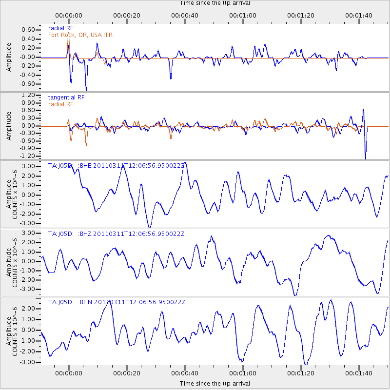
J05D Fort Rock, OR, USA - Earthquake Result Viewer
*The percent match for this event was below the threshold and hence no stack was calculated.
| Earthquake location: |
Near East Coast Of Honshu, Japan |
| Earthquake latitude/longitude: |
36.3/141.5 |
| Earthquake time(UTC): |
2011/03/11 (070) 11:56:13 GMT |
| Earthquake Depth: |
23 km |
| Earthquake Magnitude: |
5.5 MB |
| Earthquake Catalog/Contributor: |
WHDF/NEIC |
|
| Network: |
TA USArray Transportable Network (new EarthScope stations) |
| Station: |
J05D Fort Rock, OR, USA |
| Lat/Lon: |
43.28 N/121.23 W |
| Elevation: |
1541 m |
|
| Distance: |
70.9 deg |
| Az: |
50.072 deg |
| Baz: |
301.932 deg |
| Ray Param: |
$rayparam |
*The percent match for this event was below the threshold and hence was not used in the summary stack. |
|
| Radial Match: |
67.15218 % |
| Radial Bump: |
400 |
| Transverse Match: |
49.225727 % |
| Transverse Bump: |
400 |
| SOD ConfigId: |
356183 |
| Insert Time: |
2011-08-15 21:06:56.774 +0000 |
| GWidth: |
2.5 |
| Max Bumps: |
400 |
| Tol: |
0.001 |
|
Signal To Noise
| Channel | StoN | STA | LTA |
| TA:J05D: :BHZ:20110311T12:06:56.950022Z | 0.5399909 | 5.2726796E-7 | 9.764386E-7 |
| TA:J05D: :BHN:20110311T12:06:56.950022Z | 0.6290259 | 1.1415242E-6 | 1.814749E-6 |
| TA:J05D: :BHE:20110311T12:06:56.950022Z | 1.4283646 | 2.1130484E-6 | 1.4793479E-6 |
| Arrivals |
| Ps | |
| PpPs | |
| PsPs/PpSs | |


