You are here: Home > Network List > TA - USArray Transportable Network (new EarthScope stations) Stations List
> Station 336A Riesel, TX, USA > Earthquake Result Viewer
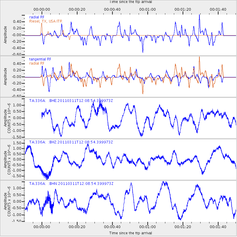
336A Riesel, TX, USA - Earthquake Result Viewer
*The percent match for this event was below the threshold and hence no stack was calculated.
| Earthquake location: |
Near East Coast Of Honshu, Japan |
| Earthquake latitude/longitude: |
36.3/141.5 |
| Earthquake time(UTC): |
2011/03/11 (070) 11:56:13 GMT |
| Earthquake Depth: |
23 km |
| Earthquake Magnitude: |
5.5 MB |
| Earthquake Catalog/Contributor: |
WHDF/NEIC |
|
| Network: |
TA USArray Transportable Network (new EarthScope stations) |
| Station: |
336A Riesel, TX, USA |
| Lat/Lon: |
31.39 N/96.84 W |
| Elevation: |
140 m |
|
| Distance: |
93.3 deg |
| Az: |
46.835 deg |
| Baz: |
316.43 deg |
| Ray Param: |
$rayparam |
*The percent match for this event was below the threshold and hence was not used in the summary stack. |
|
| Radial Match: |
49.134632 % |
| Radial Bump: |
400 |
| Transverse Match: |
64.30328 % |
| Transverse Bump: |
400 |
| SOD ConfigId: |
356183 |
| Insert Time: |
2011-08-15 21:14:41.928 +0000 |
| GWidth: |
2.5 |
| Max Bumps: |
400 |
| Tol: |
0.001 |
|
Signal To Noise
| Channel | StoN | STA | LTA |
| TA:336A: :BHZ:20110311T12:08:54.399973Z | 2.7303312 | 1.8167818E-6 | 6.6540713E-7 |
| TA:336A: :BHN:20110311T12:08:54.399973Z | 0.82277006 | 4.483289E-7 | 5.449018E-7 |
| TA:336A: :BHE:20110311T12:08:54.399973Z | 1.6879812 | 9.883519E-7 | 5.855231E-7 |
| Arrivals |
| Ps | |
| PpPs | |
| PsPs/PpSs | |


