You are here: Home > Network List > TA - USArray Transportable Network (new EarthScope stations) Stations List
> Station Q34A Chapman, KS, USA > Earthquake Result Viewer
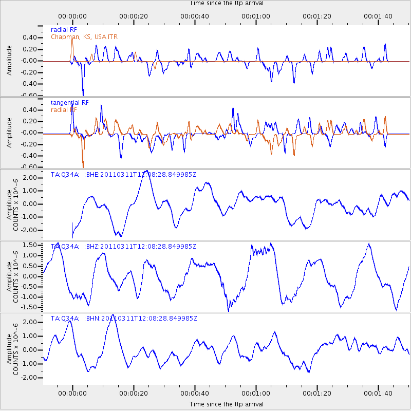
Q34A Chapman, KS, USA - Earthquake Result Viewer
*The percent match for this event was below the threshold and hence no stack was calculated.
| Earthquake location: |
Near East Coast Of Honshu, Japan |
| Earthquake latitude/longitude: |
36.3/141.5 |
| Earthquake time(UTC): |
2011/03/11 (070) 11:56:13 GMT |
| Earthquake Depth: |
23 km |
| Earthquake Magnitude: |
5.5 MB |
| Earthquake Catalog/Contributor: |
WHDF/NEIC |
|
| Network: |
TA USArray Transportable Network (new EarthScope stations) |
| Station: |
Q34A Chapman, KS, USA |
| Lat/Lon: |
38.92 N/96.94 W |
| Elevation: |
378 m |
|
| Distance: |
87.8 deg |
| Az: |
41.712 deg |
| Baz: |
316.421 deg |
| Ray Param: |
$rayparam |
*The percent match for this event was below the threshold and hence was not used in the summary stack. |
|
| Radial Match: |
66.96046 % |
| Radial Bump: |
400 |
| Transverse Match: |
45.788673 % |
| Transverse Bump: |
375 |
| SOD ConfigId: |
356183 |
| Insert Time: |
2011-08-15 21:18:31.313 +0000 |
| GWidth: |
2.5 |
| Max Bumps: |
400 |
| Tol: |
0.001 |
|
Signal To Noise
| Channel | StoN | STA | LTA |
| TA:Q34A: :BHZ:20110311T12:08:28.849985Z | 1.4401146 | 1.1053196E-6 | 7.6752195E-7 |
| TA:Q34A: :BHN:20110311T12:08:28.849985Z | 1.1675836 | 1.0717562E-6 | 9.1792674E-7 |
| TA:Q34A: :BHE:20110311T12:08:28.849985Z | 0.6137181 | 8.1013155E-7 | 1.3200385E-6 |
| Arrivals |
| Ps | |
| PpPs | |
| PsPs/PpSs | |


