You are here: Home > Network List > US - United States National Seismic Network Stations List
> Station ERPA Erie, Pennsylvania, USA > Earthquake Result Viewer
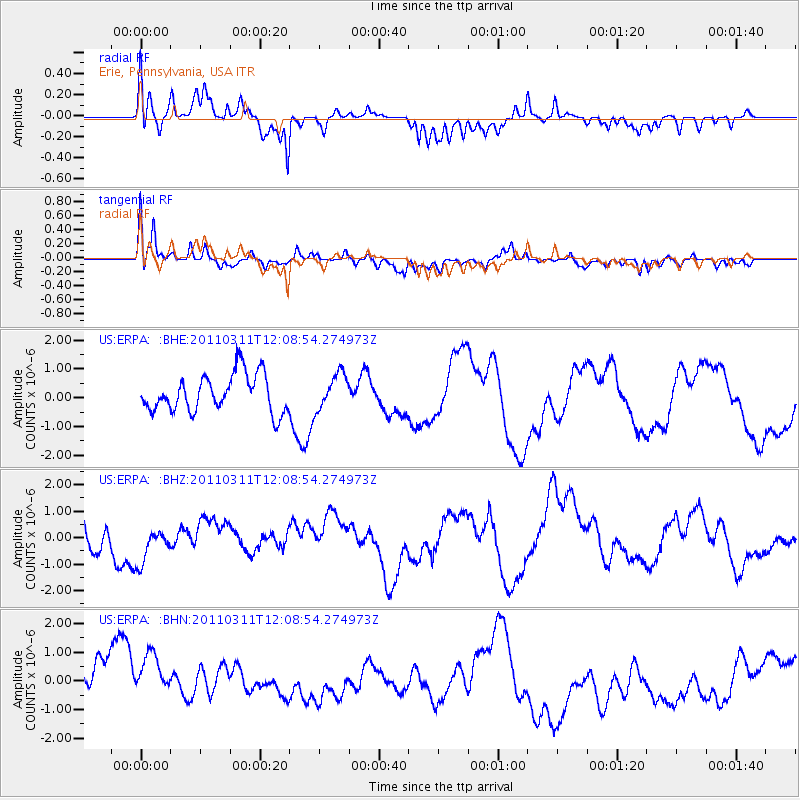
ERPA Erie, Pennsylvania, USA - Earthquake Result Viewer
*The percent match for this event was below the threshold and hence no stack was calculated.
| Earthquake location: |
Near East Coast Of Honshu, Japan |
| Earthquake latitude/longitude: |
36.3/141.5 |
| Earthquake time(UTC): |
2011/03/11 (070) 11:56:13 GMT |
| Earthquake Depth: |
23 km |
| Earthquake Magnitude: |
5.5 MB |
| Earthquake Catalog/Contributor: |
WHDF/NEIC |
|
| Network: |
US United States National Seismic Network |
| Station: |
ERPA Erie, Pennsylvania, USA |
| Lat/Lon: |
42.12 N/79.99 W |
| Elevation: |
306 m |
|
| Distance: |
93.2 deg |
| Az: |
29.6 deg |
| Baz: |
327.552 deg |
| Ray Param: |
$rayparam |
*The percent match for this event was below the threshold and hence was not used in the summary stack. |
|
| Radial Match: |
57.63117 % |
| Radial Bump: |
343 |
| Transverse Match: |
55.166054 % |
| Transverse Bump: |
400 |
| SOD ConfigId: |
356183 |
| Insert Time: |
2011-08-15 21:50:09.488 +0000 |
| GWidth: |
2.5 |
| Max Bumps: |
400 |
| Tol: |
0.001 |
|
Signal To Noise
| Channel | StoN | STA | LTA |
| US:ERPA: :BHZ:20110311T12:08:54.274973Z | 0.97359204 | 7.4580146E-7 | 7.660308E-7 |
| US:ERPA: :BHN:20110311T12:08:54.274973Z | 1.072821 | 1.0649577E-6 | 9.926704E-7 |
| US:ERPA: :BHE:20110311T12:08:54.274973Z | 0.93519956 | 6.09299E-7 | 6.515176E-7 |
| Arrivals |
| Ps | |
| PpPs | |
| PsPs/PpSs | |


