You are here: Home > Network List > TA - USArray Transportable Network (new EarthScope stations) Stations List
> Station R30A Dighton, KS, USA > Earthquake Result Viewer
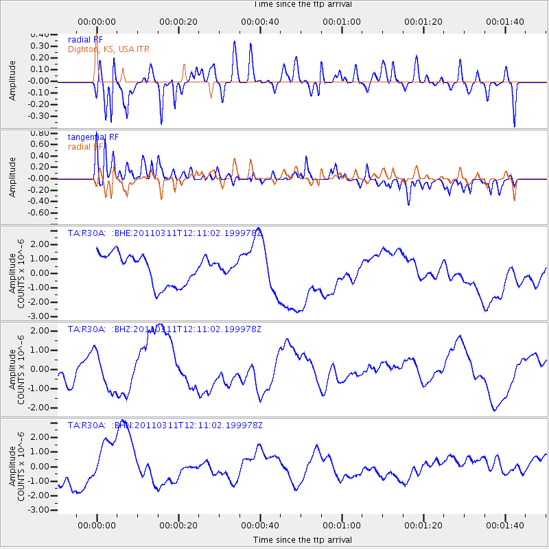
R30A Dighton, KS, USA - Earthquake Result Viewer
*The percent match for this event was below the threshold and hence no stack was calculated.
| Earthquake location: |
Off East Coast Of Honshu, Japan |
| Earthquake latitude/longitude: |
35.8/142.1 |
| Earthquake time(UTC): |
2011/03/11 (070) 11:58:54 GMT |
| Earthquake Depth: |
35 km |
| Earthquake Magnitude: |
5.6 MB |
| Earthquake Catalog/Contributor: |
WHDF/NEIC |
|
| Network: |
TA USArray Transportable Network (new EarthScope stations) |
| Station: |
R30A Dighton, KS, USA |
| Lat/Lon: |
38.28 N/100.28 W |
| Elevation: |
776 m |
|
| Distance: |
86.5 deg |
| Az: |
44.305 deg |
| Baz: |
313.785 deg |
| Ray Param: |
$rayparam |
*The percent match for this event was below the threshold and hence was not used in the summary stack. |
|
| Radial Match: |
52.19526 % |
| Radial Bump: |
400 |
| Transverse Match: |
63.369938 % |
| Transverse Bump: |
400 |
| SOD ConfigId: |
356183 |
| Insert Time: |
2011-08-15 23:09:55.635 +0000 |
| GWidth: |
2.5 |
| Max Bumps: |
400 |
| Tol: |
0.001 |
|
Signal To Noise
| Channel | StoN | STA | LTA |
| TA:R30A: :BHZ:20110311T12:11:02.199978Z | 1.5657729 | 9.350586E-7 | 5.971866E-7 |
| TA:R30A: :BHN:20110311T12:11:02.199978Z | 3.6308491 | 1.8326444E-6 | 5.047427E-7 |
| TA:R30A: :BHE:20110311T12:11:02.199978Z | 0.3068077 | 3.362876E-7 | 1.096086E-6 |
| Arrivals |
| Ps | |
| PpPs | |
| PsPs/PpSs | |


