You are here: Home > Network List > TA - USArray Transportable Network (new EarthScope stations) Stations List
> Station 334A Lometa, TX, USA > Earthquake Result Viewer
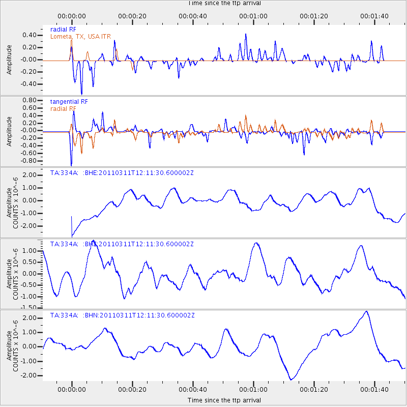
334A Lometa, TX, USA - Earthquake Result Viewer
*The percent match for this event was below the threshold and hence no stack was calculated.
| Earthquake location: |
Off East Coast Of Honshu, Japan |
| Earthquake latitude/longitude: |
35.8/142.1 |
| Earthquake time(UTC): |
2011/03/11 (070) 11:58:54 GMT |
| Earthquake Depth: |
35 km |
| Earthquake Magnitude: |
5.6 MB |
| Earthquake Catalog/Contributor: |
WHDF/NEIC |
|
| Network: |
TA USArray Transportable Network (new EarthScope stations) |
| Station: |
334A Lometa, TX, USA |
| Lat/Lon: |
31.33 N/98.24 W |
| Elevation: |
389 m |
|
| Distance: |
92.5 deg |
| Az: |
48.085 deg |
| Baz: |
314.98 deg |
| Ray Param: |
$rayparam |
*The percent match for this event was below the threshold and hence was not used in the summary stack. |
|
| Radial Match: |
82.12282 % |
| Radial Bump: |
337 |
| Transverse Match: |
45.11228 % |
| Transverse Bump: |
356 |
| SOD ConfigId: |
356183 |
| Insert Time: |
2011-08-15 23:34:54.860 +0000 |
| GWidth: |
2.5 |
| Max Bumps: |
400 |
| Tol: |
0.001 |
|
Signal To Noise
| Channel | StoN | STA | LTA |
| TA:334A: :BHZ:20110311T12:11:30.600002Z | 1.060778 | 5.2291847E-7 | 4.929575E-7 |
| TA:334A: :BHN:20110311T12:11:30.600002Z | 0.5803412 | 2.270622E-7 | 3.9125638E-7 |
| TA:334A: :BHE:20110311T12:11:30.600002Z | 1.1431894 | 1.107585E-6 | 9.688553E-7 |
| Arrivals |
| Ps | |
| PpPs | |
| PsPs/PpSs | |


