You are here: Home > Network List > KN - Kyrgyz Seismic Telemetry Network Stations List
> Station CHM KN.CHM > Earthquake Result Viewer
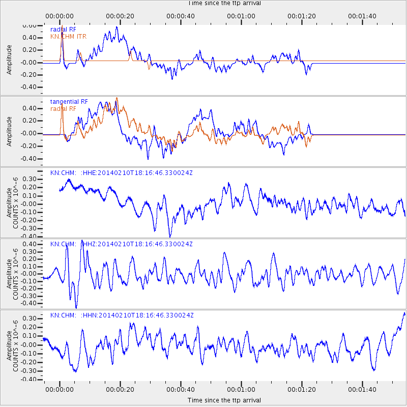
CHM KN.CHM - Earthquake Result Viewer
*The percent match for this event was below the threshold and hence no stack was calculated.
| Earthquake location: |
Timor Region |
| Earthquake latitude/longitude: |
-8.2/124.5 |
| Earthquake time(UTC): |
2014/02/10 (041) 18:06:17 GMT |
| Earthquake Depth: |
19 km |
| Earthquake Magnitude: |
5.5 MWB, 5.6 MWC |
| Earthquake Catalog/Contributor: |
NEIC PDE/NEIC COMCAT |
|
| Network: |
KN Kyrgyz Seismic Telemetry Network |
| Station: |
CHM KN.CHM |
| Lat/Lon: |
43.00 N/74.75 E |
| Elevation: |
655 m |
|
| Distance: |
68.1 deg |
| Az: |
322.869 deg |
| Baz: |
125.465 deg |
| Ray Param: |
$rayparam |
*The percent match for this event was below the threshold and hence was not used in the summary stack. |
|
| Radial Match: |
39.95342 % |
| Radial Bump: |
400 |
| Transverse Match: |
25.801107 % |
| Transverse Bump: |
400 |
| SOD ConfigId: |
3390531 |
| Insert Time: |
2019-04-10 07:26:41.802 +0000 |
| GWidth: |
2.5 |
| Max Bumps: |
400 |
| Tol: |
0.001 |
|
Signal To Noise
| Channel | StoN | STA | LTA |
| KN:CHM: :HHZ:20140210T18:16:46.330024Z | 3.4960642 | 1.8682617E-7 | 5.3439E-8 |
| KN:CHM: :HHN:20140210T18:16:46.330024Z | 0.8163063 | 1.4702051E-7 | 1.801046E-7 |
| KN:CHM: :HHE:20140210T18:16:46.330024Z | 3.188396 | 2.5513307E-7 | 8.0019255E-8 |
| Arrivals |
| Ps | |
| PpPs | |
| PsPs/PpSs | |


