You are here: Home > Network List > IW - Intermountain West Stations List
> Station DLMT Dillon, Montana, USA > Earthquake Result Viewer
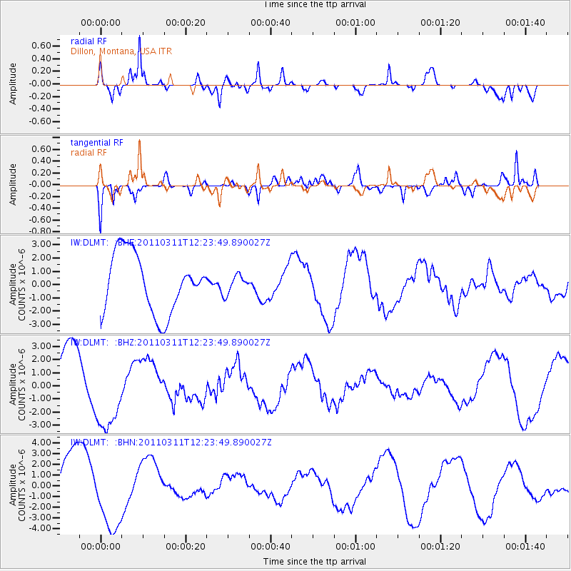
DLMT Dillon, Montana, USA - Earthquake Result Viewer
*The percent match for this event was below the threshold and hence no stack was calculated.
| Earthquake location: |
Near East Coast Of Honshu, Japan |
| Earthquake latitude/longitude: |
38.1/142.5 |
| Earthquake time(UTC): |
2011/03/11 (070) 12:12:54 GMT |
| Earthquake Depth: |
35 km |
| Earthquake Magnitude: |
5.9 MB |
| Earthquake Catalog/Contributor: |
WHDF/NEIC |
|
| Network: |
IW Intermountain West |
| Station: |
DLMT Dillon, Montana, USA |
| Lat/Lon: |
45.36 N/112.60 W |
| Elevation: |
1569 m |
|
| Distance: |
73.0 deg |
| Az: |
45.45 deg |
| Baz: |
307.063 deg |
| Ray Param: |
$rayparam |
*The percent match for this event was below the threshold and hence was not used in the summary stack. |
|
| Radial Match: |
77.647255 % |
| Radial Bump: |
400 |
| Transverse Match: |
89.364 % |
| Transverse Bump: |
400 |
| SOD ConfigId: |
356183 |
| Insert Time: |
2011-08-16 01:08:58.973 +0000 |
| GWidth: |
2.5 |
| Max Bumps: |
400 |
| Tol: |
0.001 |
|
Signal To Noise
| Channel | StoN | STA | LTA |
| IW:DLMT: :BHZ:20110311T12:23:49.890027Z | 1.7693652 | 3.0146052E-6 | 1.7037778E-6 |
| IW:DLMT: :BHN:20110311T12:23:49.890027Z | 1.3658415 | 3.535876E-6 | 2.5887894E-6 |
| IW:DLMT: :BHE:20110311T12:23:49.890027Z | 0.3127049 | 6.8456364E-7 | 2.1891685E-6 |
| Arrivals |
| Ps | |
| PpPs | |
| PsPs/PpSs | |


