You are here: Home > Network List > TA - USArray Transportable Network (new EarthScope stations) Stations List
> Station SFIN Lafayette, IN, USA > Earthquake Result Viewer
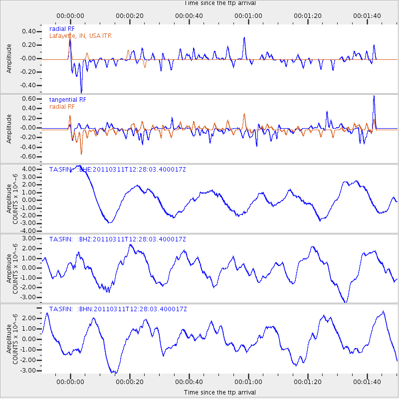
SFIN Lafayette, IN, USA - Earthquake Result Viewer
*The percent match for this event was below the threshold and hence no stack was calculated.
| Earthquake location: |
Near East Coast Of Honshu, Japan |
| Earthquake latitude/longitude: |
39.1/142.3 |
| Earthquake time(UTC): |
2011/03/11 (070) 12:15:45 GMT |
| Earthquake Depth: |
50 km |
| Earthquake Magnitude: |
5.8 MB |
| Earthquake Catalog/Contributor: |
WHDF/NEIC |
|
| Network: |
TA USArray Transportable Network (new EarthScope stations) |
| Station: |
SFIN Lafayette, IN, USA |
| Lat/Lon: |
40.38 N/87.10 W |
| Elevation: |
165 m |
|
| Distance: |
89.0 deg |
| Az: |
35.435 deg |
| Baz: |
323.795 deg |
| Ray Param: |
$rayparam |
*The percent match for this event was below the threshold and hence was not used in the summary stack. |
|
| Radial Match: |
68.81103 % |
| Radial Bump: |
400 |
| Transverse Match: |
71.05104 % |
| Transverse Bump: |
380 |
| SOD ConfigId: |
356183 |
| Insert Time: |
2011-08-16 03:38:25.185 +0000 |
| GWidth: |
2.5 |
| Max Bumps: |
400 |
| Tol: |
0.001 |
|
Signal To Noise
| Channel | StoN | STA | LTA |
| TA:SFIN: :BHZ:20110311T12:28:03.400017Z | 0.79507536 | 9.0936254E-7 | 1.1437438E-6 |
| TA:SFIN: :BHN:20110311T12:28:03.400017Z | 1.7148067 | 1.4360592E-6 | 8.3744663E-7 |
| TA:SFIN: :BHE:20110311T12:28:03.400017Z | 0.9745213 | 2.2507825E-6 | 2.3096288E-6 |
| Arrivals |
| Ps | |
| PpPs | |
| PsPs/PpSs | |


