You are here: Home > Network List > TA - USArray Transportable Network (new EarthScope stations) Stations List
> Station F27A Lemmon, SD, USA > Earthquake Result Viewer
F27A Lemmon, SD, USA - Earthquake Result Viewer
*The percent match for this event was below the threshold and hence no stack was calculated.
| Earthquake location: |
Near East Coast Of Honshu, Japan |
| Earthquake latitude/longitude: |
39.1/142.3 |
| Earthquake time(UTC): |
2011/03/11 (070) 12:15:45 GMT |
| Earthquake Depth: |
50 km |
| Earthquake Magnitude: |
5.8 MB |
| Earthquake Catalog/Contributor: |
WHDF/NEIC |
|
| Network: |
TA USArray Transportable Network (new EarthScope stations) |
| Station: |
F27A Lemmon, SD, USA |
| Lat/Lon: |
45.87 N/102.02 W |
| Elevation: |
757 m |
|
| Distance: |
77.7 deg |
| Az: |
40.113 deg |
| Baz: |
314.133 deg |
| Ray Param: |
$rayparam |
*The percent match for this event was below the threshold and hence was not used in the summary stack. |
|
| Radial Match: |
95.49107 % |
| Radial Bump: |
259 |
| Transverse Match: |
53.330063 % |
| Transverse Bump: |
346 |
| SOD ConfigId: |
356183 |
| Insert Time: |
2011-08-16 03:46:27.218 +0000 |
| GWidth: |
2.5 |
| Max Bumps: |
400 |
| Tol: |
0.001 |
|
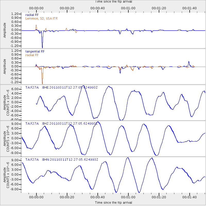
Signal To Noise
| Channel | StoN | STA | LTA |
| TA:F27A: :BHZ:20110311T12:27:05.624993Z | 1.1624233 | 4.2726015E-6 | 3.6755987E-6 |
| TA:F27A: :BHN:20110311T12:27:05.624993Z | 0.5376038 | 2.9202606E-6 | 5.431994E-6 |
| TA:F27A: :BHE:20110311T12:27:05.624993Z | 2.385765 | 6.330807E-6 | 2.6535752E-6 |
| Arrivals |
| Ps | |
| PpPs | |
| PsPs/PpSs | |


