You are here: Home > Network List > TA - USArray Transportable Network (new EarthScope stations) Stations List
> Station N02D Trinity Center, CA, USA > Earthquake Result Viewer
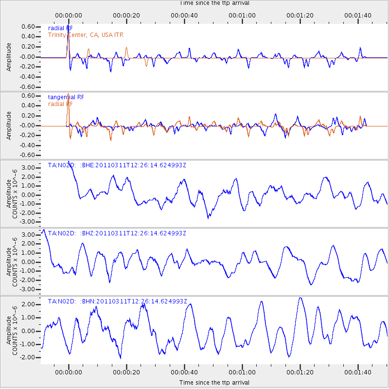
N02D Trinity Center, CA, USA - Earthquake Result Viewer
*The percent match for this event was below the threshold and hence no stack was calculated.
| Earthquake location: |
Near East Coast Of Honshu, Japan |
| Earthquake latitude/longitude: |
39.1/142.3 |
| Earthquake time(UTC): |
2011/03/11 (070) 12:15:45 GMT |
| Earthquake Depth: |
50 km |
| Earthquake Magnitude: |
5.8 MB |
| Earthquake Catalog/Contributor: |
WHDF/NEIC |
|
| Network: |
TA USArray Transportable Network (new EarthScope stations) |
| Station: |
N02D Trinity Center, CA, USA |
| Lat/Lon: |
40.97 N/122.71 W |
| Elevation: |
937 m |
|
| Distance: |
69.0 deg |
| Az: |
53.897 deg |
| Baz: |
303.851 deg |
| Ray Param: |
$rayparam |
*The percent match for this event was below the threshold and hence was not used in the summary stack. |
|
| Radial Match: |
44.479477 % |
| Radial Bump: |
358 |
| Transverse Match: |
65.94803 % |
| Transverse Bump: |
362 |
| SOD ConfigId: |
356183 |
| Insert Time: |
2011-08-16 03:57:23.878 +0000 |
| GWidth: |
2.5 |
| Max Bumps: |
400 |
| Tol: |
0.001 |
|
Signal To Noise
| Channel | StoN | STA | LTA |
| TA:N02D: :BHZ:20110311T12:26:14.624993Z | 0.5488612 | 1.4370754E-6 | 2.6182854E-6 |
| TA:N02D: :BHN:20110311T12:26:14.624993Z | 1.033172 | 8.878698E-7 | 8.59363E-7 |
| TA:N02D: :BHE:20110311T12:26:14.624993Z | 1.4696816 | 1.5508122E-6 | 1.0552028E-6 |
| Arrivals |
| Ps | |
| PpPs | |
| PsPs/PpSs | |


