You are here: Home > Network List > TA - USArray Transportable Network (new EarthScope stations) Stations List
> Station Z38A Mt. Pleasant, TX, USA > Earthquake Result Viewer
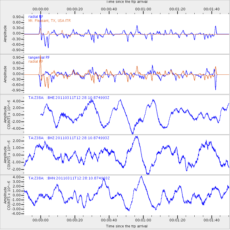
Z38A Mt. Pleasant, TX, USA - Earthquake Result Viewer
*The percent match for this event was below the threshold and hence no stack was calculated.
| Earthquake location: |
Near East Coast Of Honshu, Japan |
| Earthquake latitude/longitude: |
39.1/142.3 |
| Earthquake time(UTC): |
2011/03/11 (070) 12:15:45 GMT |
| Earthquake Depth: |
50 km |
| Earthquake Magnitude: |
5.8 MB |
| Earthquake Catalog/Contributor: |
WHDF/NEIC |
|
| Network: |
TA USArray Transportable Network (new EarthScope stations) |
| Station: |
Z38A Mt. Pleasant, TX, USA |
| Lat/Lon: |
33.25 N/94.99 W |
| Elevation: |
116 m |
|
| Distance: |
90.6 deg |
| Az: |
44.813 deg |
| Baz: |
319.111 deg |
| Ray Param: |
$rayparam |
*The percent match for this event was below the threshold and hence was not used in the summary stack. |
|
| Radial Match: |
59.7869 % |
| Radial Bump: |
400 |
| Transverse Match: |
50.194084 % |
| Transverse Bump: |
305 |
| SOD ConfigId: |
356183 |
| Insert Time: |
2011-08-16 04:05:10.468 +0000 |
| GWidth: |
2.5 |
| Max Bumps: |
400 |
| Tol: |
0.001 |
|
Signal To Noise
| Channel | StoN | STA | LTA |
| TA:Z38A: :BHZ:20110311T12:28:10.874993Z | 2.4182382 | 2.0923171E-6 | 8.6522374E-7 |
| TA:Z38A: :BHN:20110311T12:28:10.874993Z | 0.3728713 | 2.8906905E-7 | 7.752515E-7 |
| TA:Z38A: :BHE:20110311T12:28:10.874993Z | 2.015141 | 3.0370713E-6 | 1.507126E-6 |
| Arrivals |
| Ps | |
| PpPs | |
| PsPs/PpSs | |


