You are here: Home > Network List > TA - USArray Transportable Network (new EarthScope stations) Stations List
> Station O03D Paynes Creek, CA, USA > Earthquake Result Viewer
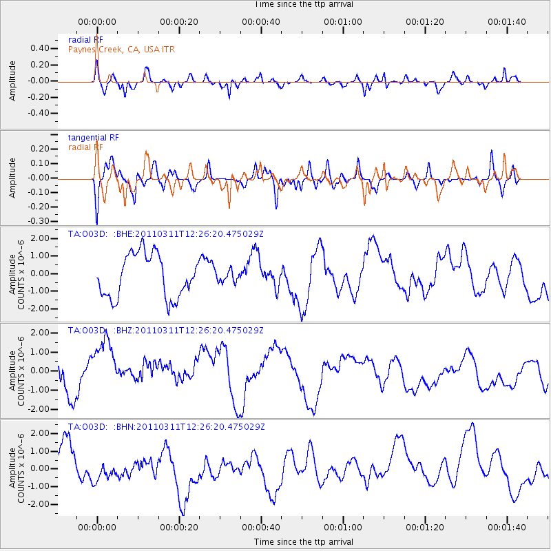
O03D Paynes Creek, CA, USA - Earthquake Result Viewer
*The percent match for this event was below the threshold and hence no stack was calculated.
| Earthquake location: |
Near East Coast Of Honshu, Japan |
| Earthquake latitude/longitude: |
39.1/142.3 |
| Earthquake time(UTC): |
2011/03/11 (070) 12:15:45 GMT |
| Earthquake Depth: |
50 km |
| Earthquake Magnitude: |
5.8 MB |
| Earthquake Catalog/Contributor: |
WHDF/NEIC |
|
| Network: |
TA USArray Transportable Network (new EarthScope stations) |
| Station: |
O03D Paynes Creek, CA, USA |
| Lat/Lon: |
40.29 N/121.80 W |
| Elevation: |
968 m |
|
| Distance: |
69.9 deg |
| Az: |
54.084 deg |
| Baz: |
304.503 deg |
| Ray Param: |
$rayparam |
*The percent match for this event was below the threshold and hence was not used in the summary stack. |
|
| Radial Match: |
50.63226 % |
| Radial Bump: |
380 |
| Transverse Match: |
45.004536 % |
| Transverse Bump: |
400 |
| SOD ConfigId: |
356183 |
| Insert Time: |
2011-08-16 04:15:41.947 +0000 |
| GWidth: |
2.5 |
| Max Bumps: |
400 |
| Tol: |
0.001 |
|
Signal To Noise
| Channel | StoN | STA | LTA |
| TA:O03D: :BHZ:20110311T12:26:20.475029Z | 1.0617187 | 3.0183248E-6 | 2.8428667E-6 |
| TA:O03D: :BHN:20110311T12:26:20.475029Z | 0.80281186 | 7.141664E-7 | 8.8958126E-7 |
| TA:O03D: :BHE:20110311T12:26:20.475029Z | 0.24661033 | 3.0145654E-7 | 1.2224003E-6 |
| Arrivals |
| Ps | |
| PpPs | |
| PsPs/PpSs | |


