You are here: Home > Network List > TA - USArray Transportable Network (new EarthScope stations) Stations List
> Station N59A State Game Land 141, Hazleton, PA, USA > Earthquake Result Viewer
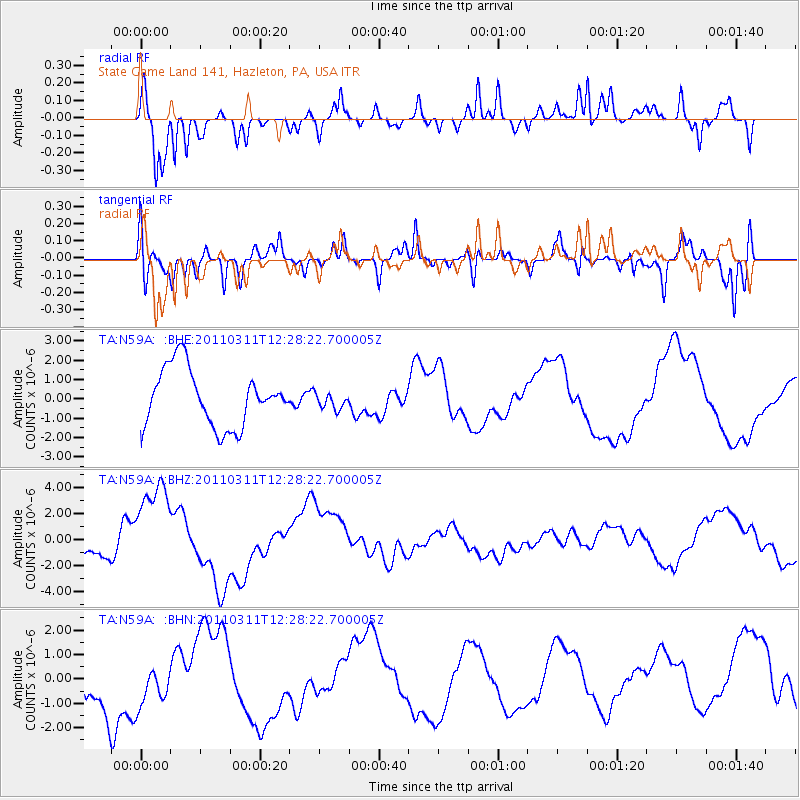
N59A State Game Land 141, Hazleton, PA, USA - Earthquake Result Viewer
*The percent match for this event was below the threshold and hence no stack was calculated.
| Earthquake location: |
Near East Coast Of Honshu, Japan |
| Earthquake latitude/longitude: |
39.1/142.3 |
| Earthquake time(UTC): |
2011/03/11 (070) 12:15:45 GMT |
| Earthquake Depth: |
50 km |
| Earthquake Magnitude: |
5.8 MB |
| Earthquake Catalog/Contributor: |
WHDF/NEIC |
|
| Network: |
TA USArray Transportable Network (new EarthScope stations) |
| Station: |
N59A State Game Land 141, Hazleton, PA, USA |
| Lat/Lon: |
40.92 N/75.77 W |
| Elevation: |
508 m |
|
| Distance: |
93.1 deg |
| Az: |
27.881 deg |
| Baz: |
331.298 deg |
| Ray Param: |
$rayparam |
*The percent match for this event was below the threshold and hence was not used in the summary stack. |
|
| Radial Match: |
72.30151 % |
| Radial Bump: |
400 |
| Transverse Match: |
62.691 % |
| Transverse Bump: |
400 |
| SOD ConfigId: |
356183 |
| Insert Time: |
2011-08-16 04:30:32.085 +0000 |
| GWidth: |
2.5 |
| Max Bumps: |
400 |
| Tol: |
0.001 |
|
Signal To Noise
| Channel | StoN | STA | LTA |
| TA:N59A: :BHZ:20110311T12:28:22.700005Z | 2.4982939 | 3.955548E-6 | 1.5832998E-6 |
| TA:N59A: :BHN:20110311T12:28:22.700005Z | 0.65352774 | 1.2363108E-6 | 1.8917495E-6 |
| TA:N59A: :BHE:20110311T12:28:22.700005Z | 0.28679177 | 4.1844746E-7 | 1.4590637E-6 |
| Arrivals |
| Ps | |
| PpPs | |
| PsPs/PpSs | |


